Rising Stars
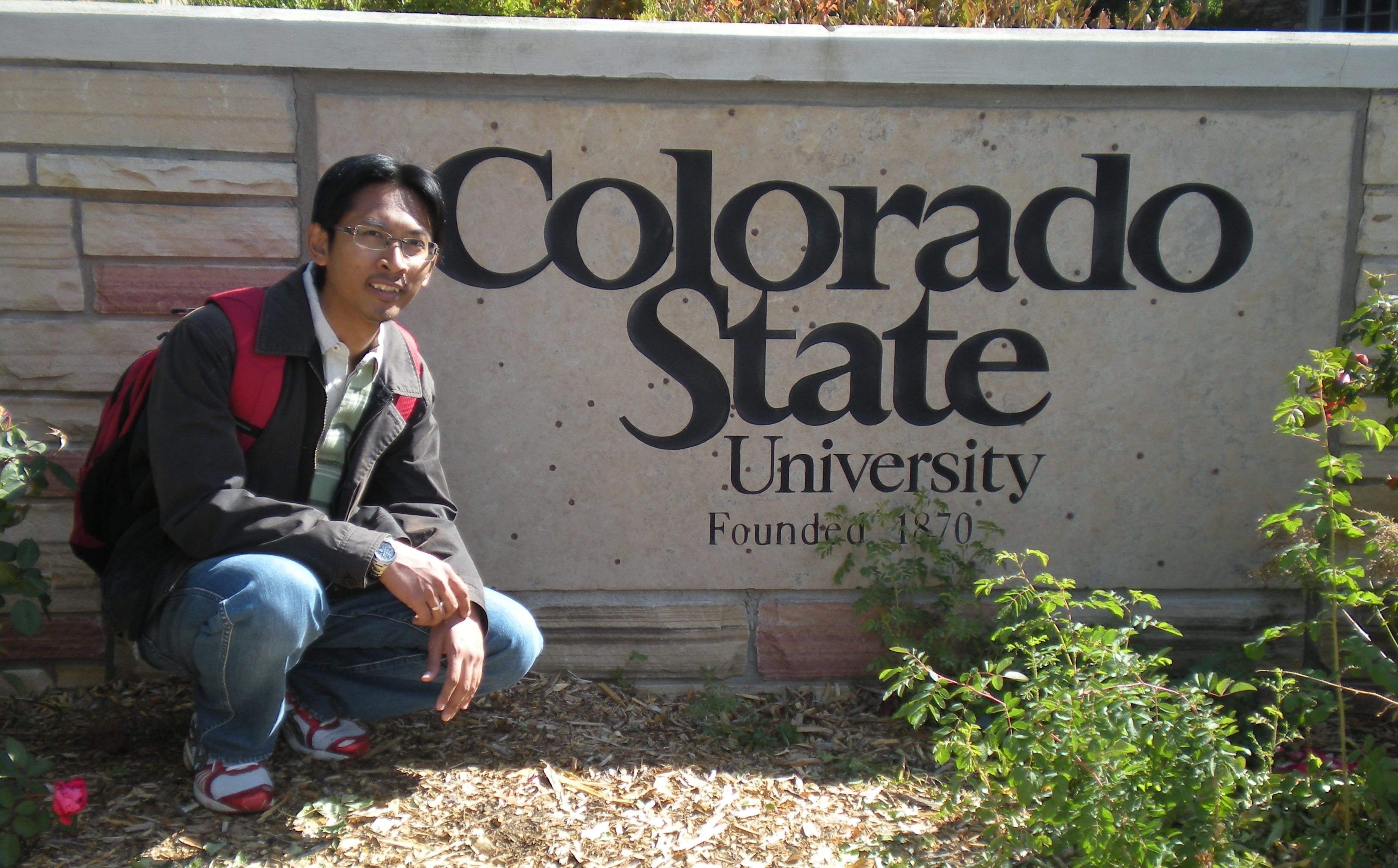
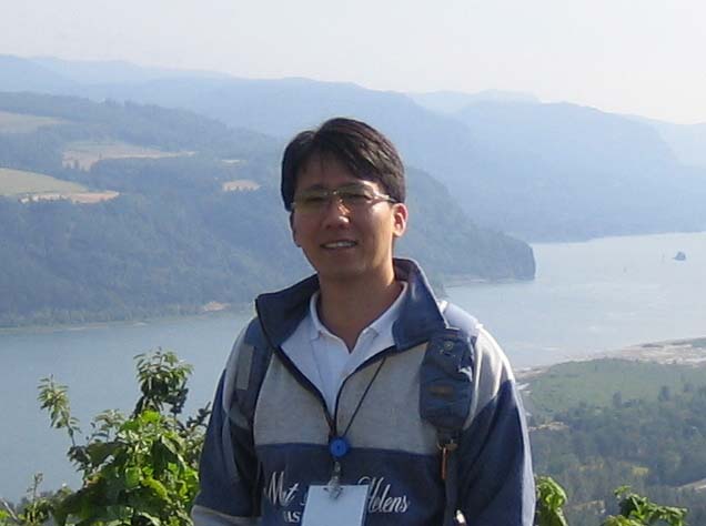
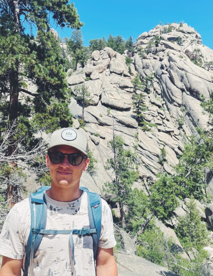
This is the recent research team of Prof. Pierre Y. Julien
at Colorado State University

Jazuri Abdullah
Sangdo An
Tristen Anderson
Neil Andika
Tori Beckwith
Ted Bender

Brianna Corsi
Susan Cundiff

Sydney Doidge
John England
Caitlin Fogarty
Noah Friesen

James Halgren
Corinne Horner
Dohyuk Kang
Woochul Kang
Hwa Young Kim
Hyeonsik Kim
Jaehoon Kim
Nick Koutsunis
Andrew Schied
Atikah Shafie
Seema Shah-Fairbank
Youngho Shin
Josh Sperry
Andy Steininger
Soo Huey Teh
Mark Velleux
Chad Vensel
Mark R Weinhold
Chunyao Yang

Other Advisees


Jazuri Abdullah, Ph.D. Candidate 

Jazuri Abdullah

Ph.D. in 2013 -   Dissertation
Hydraulic Engineering


Research:
Flashflood Modeling in Malaysia 


Publications:  

Jazuri obtained his bachelor degree in Civil Engineering in 2001 from Universiti Teknologi MARA, Malaysia and Master of Science in Water Resources Engineering and Management (WAREM) from Stuttgart Universitaet, Germany, in 2007. Currently he is working as a lecturer at Universiti Teknologi MARA, Malaysia.

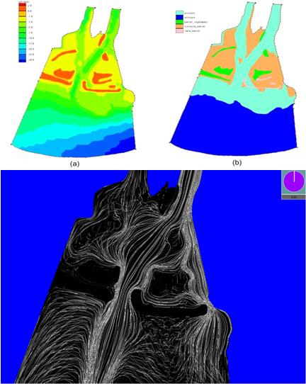
The Hulu Langat district is located between Kuala Lumpur and Putrajaya has been experiencing various developments – transformation from an agricultural area to open land field and residential purposes. And as a result, the sediment load to the river is increasing every day. Previous research used laboratory approach to predict sediment load. This research uses TREX to calculate and predict sediment load. Currently the hydrological model is ready to be calibrated, followed by the validation process to evaluate the applicability of TREX on Malaysia’s climate (tropical climate). Figures A shows the land use at the Hulu Langat and the red-polygon is Lui catchment (area approx. 68 sq. km) used to calibrate and validate the hydrological model, and Figure B shows the results from calibration and validation at peak.


top


Sangdo enjoying life near reservoirs.

Sangdo An

Ph.D. in 2011 - Dissertation
Hydraulic Engineering


Research:

3-D Modeling of Sediment Interflow in Large Reservoirs 


Refereed Publications:  
Sangdo An is graduate student in Civil Engineering at Colorado State University. 
 He is currently studying PhD in hydraulics.  He graduated fromChungbuk National University,
South Korea in 2001 with a MS degree in Hydro-system Engineering. Since 2002,
He has been working for Korea Water Resources Corporation (K water), 

which is establishing an integrated water management system focused on water
utilization and flood control.  At K water, he usually did detailed design and 3D numerical 

analysis for multi-purpose dam.

He is now interested in turbidity flow analysis using various numerical models.
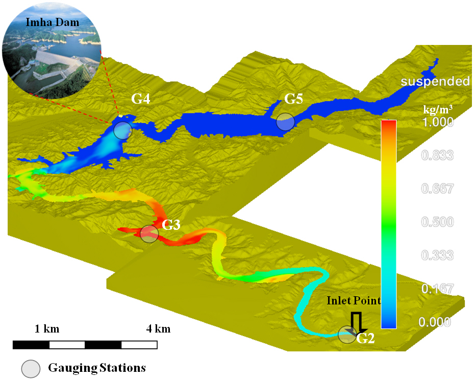
Recently, high turbidity flow became a big issue in Korea because the turbidity effects  into several parts badly such as fishery and sightseeing, and water treatment.  The Imha reservoir is the worst reservoir which has a high turbidity problem in Korea.  Sangdo is going to establish the Turbidity Flow Simulation System using various numerical models for Imha reservoir for his dissertation.
                                                                                                                                       
top


Tristen Anderson

M.S. in 2023 - Technical Report
Hydraulic Engineering  - HEC-RAS Lecture


Research:  
Hydraulic Analysis of the Montano Reach of the Middle Rio Grande, NM


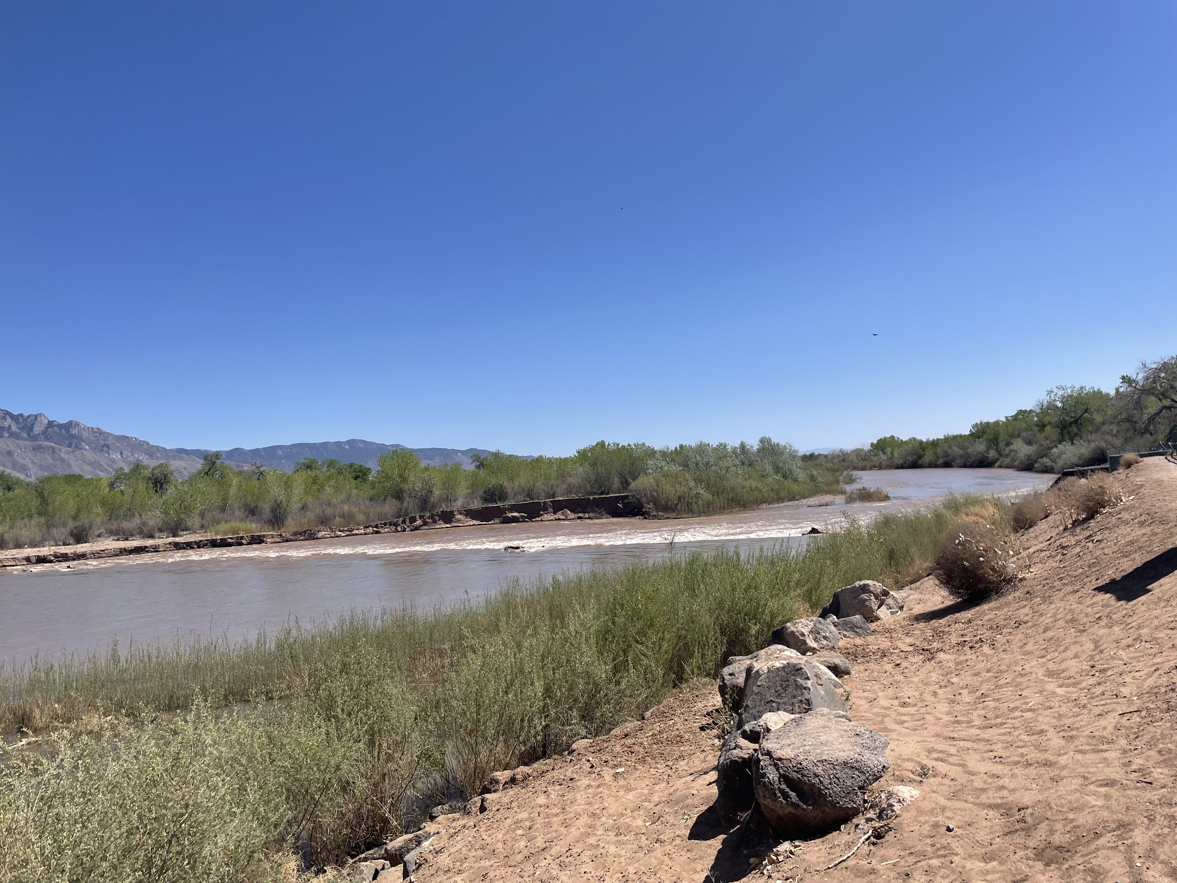
Tristen is pursuing a Master’s in Hydraulic Engineering at Colorado State University. He received his Bachelor of Science degree in Civil Engineering from the University of Minnesota Duluth in 2019. In his free time, Tristen likes to mountain bike, hike, camp, and travel to new places. 

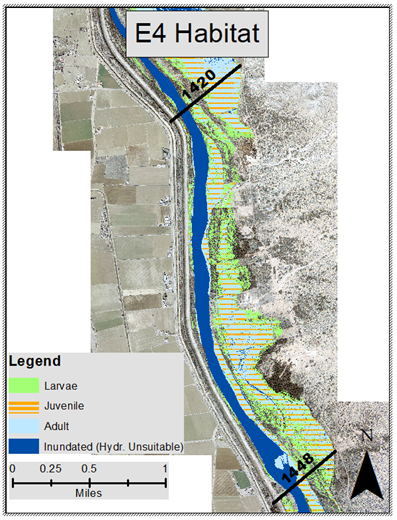
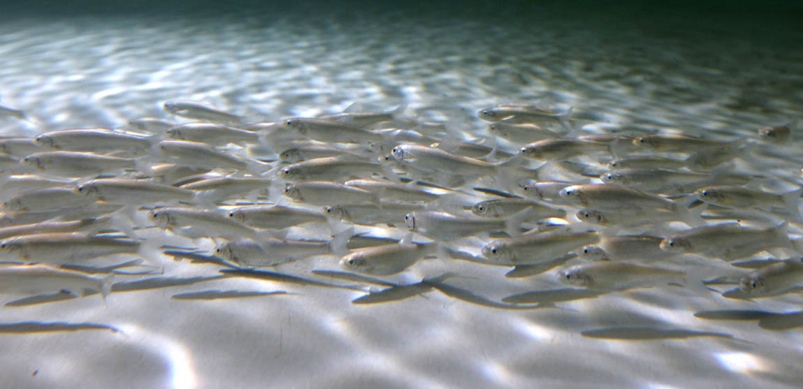
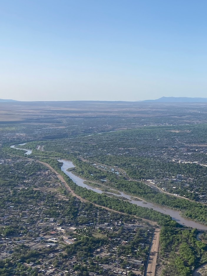
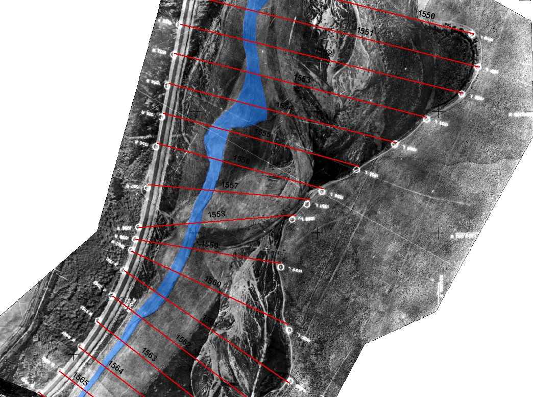
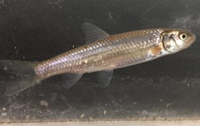
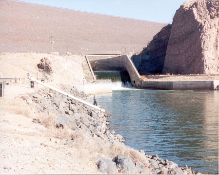
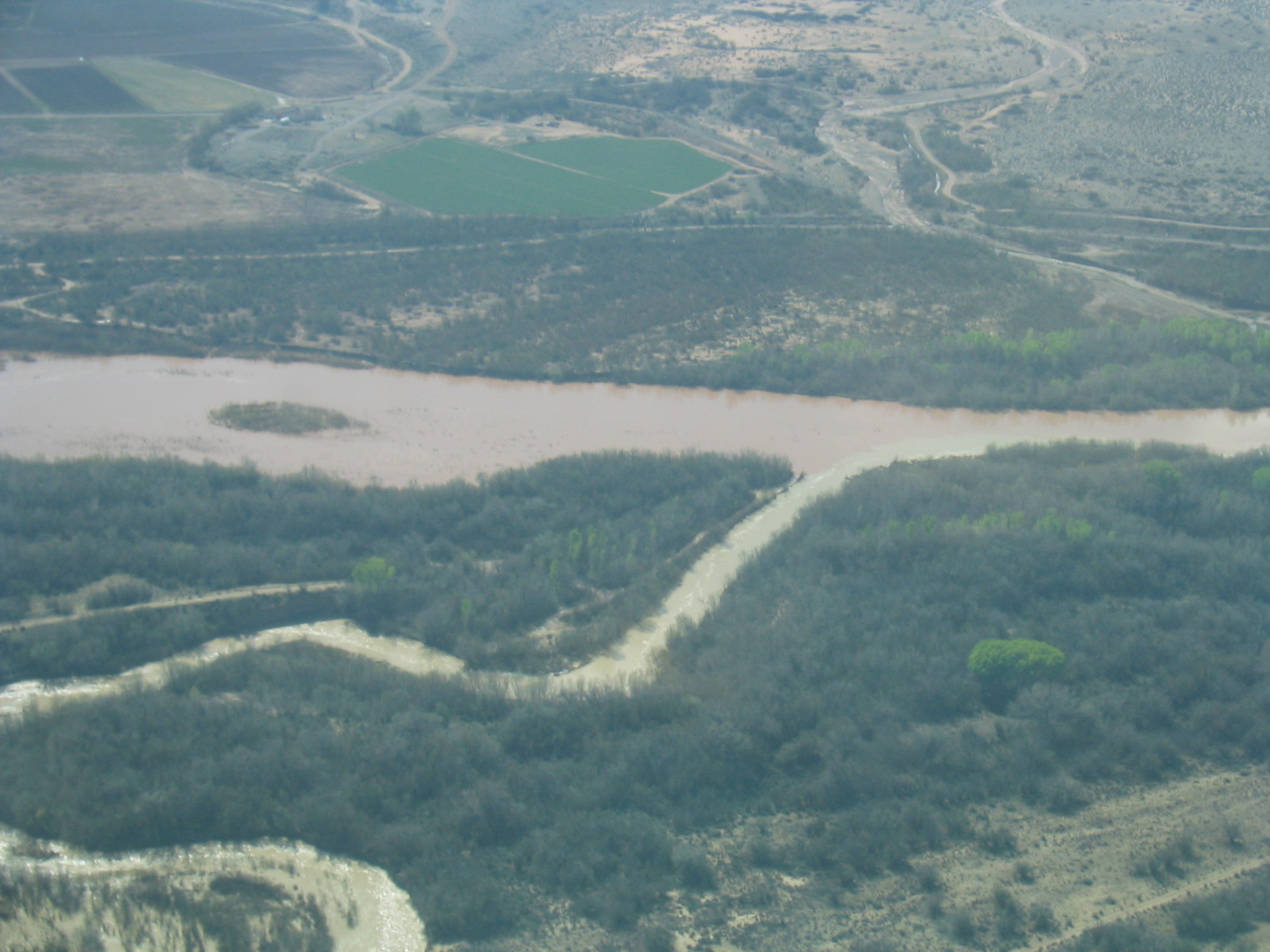
Tristen’s research is to evaluate geomorphic changes within the Montaño Reach of the Middle Rio Grande, which extends from Montaño Road in Albuquerque, NM to the Isleta Diversion Dam in Bosque Farms, NM. Using topographic data, a 1D HEC-RAS hydraulic model was created to relate hydraulic conditions (velocity and depth) to suitable habitat for the endangered Rio Grande Silvery Minnow. The hydraulic model results paired with aerial imagery are used to generate habitat maps – A map showing the areas of available habitat for each life stage of the Silvery Minnow. Tristen’s research will be used to help with conservation efforts for the Silvery Minnow. 
top


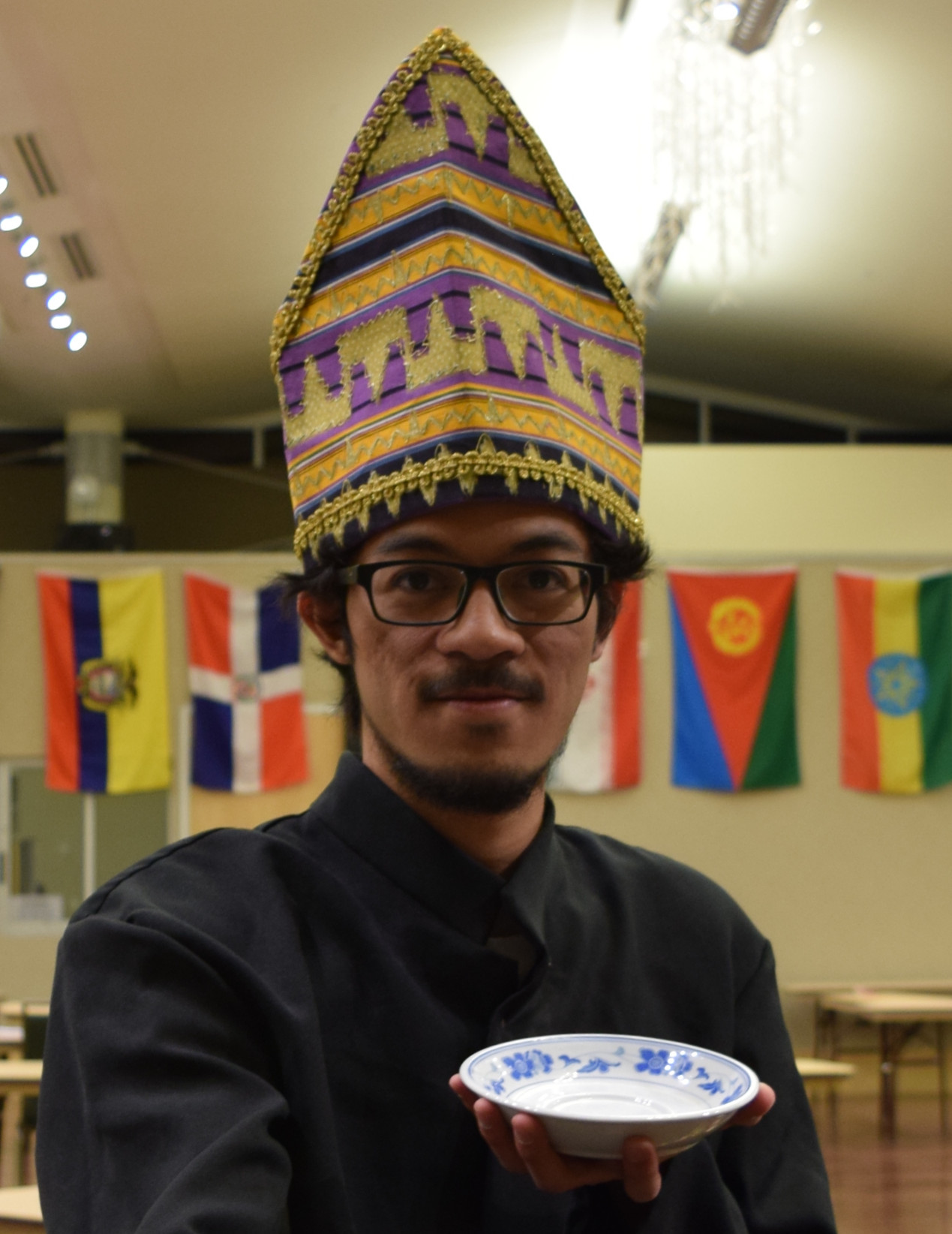
Neil  at the CSU World Unity Fair

Neil Andika

Ph.D. in 2021 - Dissertation
Hydraulic Engineering


Research:
River rehabilitation from the Sidoarjo mud vol
cano, Indonesia


Refereed Publications:  
 

I am a Ph.D. student from Bekasi, Indonesia. I obtained my Bachelor degree in Civil and Environmental Engineering from Universitas Gadjah Mada, Yogyakarta, Indonesia in November 2013. Before he started his Master Degree, I did an internship for 6 months with a national contractor in Indonesia about a construction of a floodway tunnel in Jakarta to reduce the flood damage in the region. Then, I obtained my Master degree in May 2016 from Colorado State University. I am interested in hydraulic engineering, river engineering, flood control and water resources management.

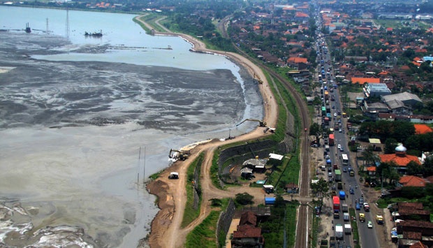
The Sidoardjo mud flow is a disaster that started on May 29, 2006 at drilling point of Lapindo Brantas Inc. at Sidoarjo, East Java, Indonesia. This mud flow acts like a mud volcano and spouts a volcanic mud from under the earth surface. Until March 22, 2007, the mud flow has drown at least 650 ha and caused many resident to evacuate based on data from the National Mudflow Disaster Management Team. The mud flow is predicted to last for at least 30 more years. In recent years, the average discharge of mud flow is approximately 50,000 m3/day. To mitigate the damage from Sidoardjo mud flow, the Team took an action to discharge the mud to Madura Strait through Porong River. The purpose of this research is to determine the optimal sediment concentration at Porong River to maximize the sediment transport capacity of the Porong River, considering the characteristics of the mud as non-Newtonian fluid, yield strength, fall velocity and discharges in Porong River and also propose the storage management strategies to mitigate the mud accumulation problem.

                                               
top


Tori Beckwith

M.S. in 2020 - Technical Report
Hydraulic Engineering


Perched River

 Research:  
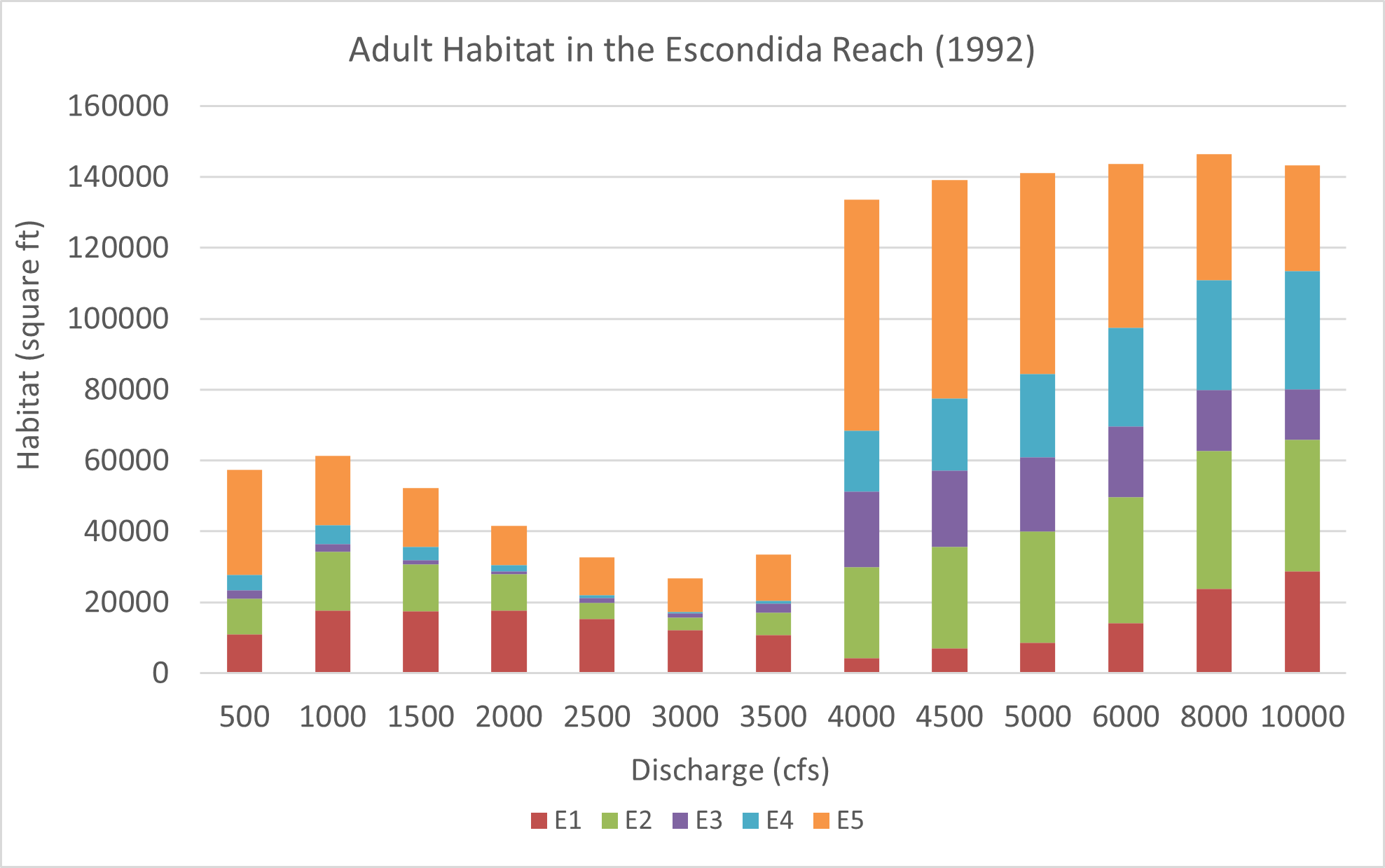
Aquatic Habitat of the Escondida Reach, Middle Rio Grande, NM
 

ArkRiverSlide

Tori is pursuing a master's degree in Hydraulic Engineering at Colorado State University. She graduated from CSU with a Bachelor of Science in Chemical and Biological Engineering in 2017. In her free time, Tori enjoys training for triathlons, trail running, and spending time outdoors.

Tori's research focused on analyzing the morpho-dynamic processes of the Escondida reach, a portion of the Middle Rio Grande located near Escondida, New Mexico. She created a reach report for the United States Bureau of Reclamation to present various changes to the Escondida reach since 1918 as well as identify areas that meet specific depth and velocity criteria required to provide hydraulically suitable habitat for the Rio Grande Silvery Minnow. The Rio Grande Silvery Minnow is an endangered species of fish that once spanned the Middle Rio Grande, but now struggles to survive in its native habitat. In addition, Tori collaborated with other members from CSU, ASIR, and UNM to create a process linkage report, which links the geomorphology and hydrology of the river to the biological needs of the RGSM.


top


Ted Bender

M.S. in 2012 - Technical Report
Hydraulic Engineering


Research:  
Hydraulic Analysis of the Bosque Reach of the Middle Rio Grande, NM
 

ArkRiverSlideTed is a master’s student at Colorado State University, majoring in Hydraulic Engineering.  He obtained his Bachelor of Science degree in Civil Engineering in May 2005 from The University of Kansas.  After graduation, he served 5 years in the United States Navy and began his graduate work in August 2010.  Ted and his wife Susie enjoy the Colorado outdoors and love watching Jayhawk basketball…Rock Chalk!

 The headwaters of the Rio Grande River form in southern Colorado and flow south to the Gulf of Mexico.  The Middle Rio Grande, located in New Mexico, has undergone many changes in its recent history.  These changes, stemming from the construction of several dams and other channelization projects, has led the United States Bureau of Reclamation, in conjunction with Colorado State University, to complete several hydraulic analyses for different reaches in the river.  Ted is studying the Bosque reach.  This reach is approximately 23 miles long, stretching from the Arroyo de las Canas to the southern boundary of the Bosque del Apache National Wildlife Refuge.

Ted is using HEC-RAS, a 1-dimensional hydraulic model, to determine the water surface elevation profiles for the Bosque reach of the Middle Rio Grande.  His analysis includes simulations for 25 flow discharges varying in increments of 200 cfs up to 5,000 cfs.  This analysis is to provide a better understanding of the historical overbanking throughout this reach.  To achieve this, Ted is repeating his analysis with four different bed geometry conditions based on HEC-RAS model geometries for 1962, 1972, 1992, and 2002.  These HEC-RAS models, in conjunction with aerial photographs analyzed using a GIS, will aid in his analysis.  A total of 100 different hydraulic simulations will be completed to be analyzed in his reach report.


top

 
Brianna enjoys rivers

Brianna Corsi

M.S. in 2024 - Technical report
Hydraulic Engineering


Research:

Hydraulic Analysis of the Bernalillo Reach of the Middle Rio Grande, NM


minnows

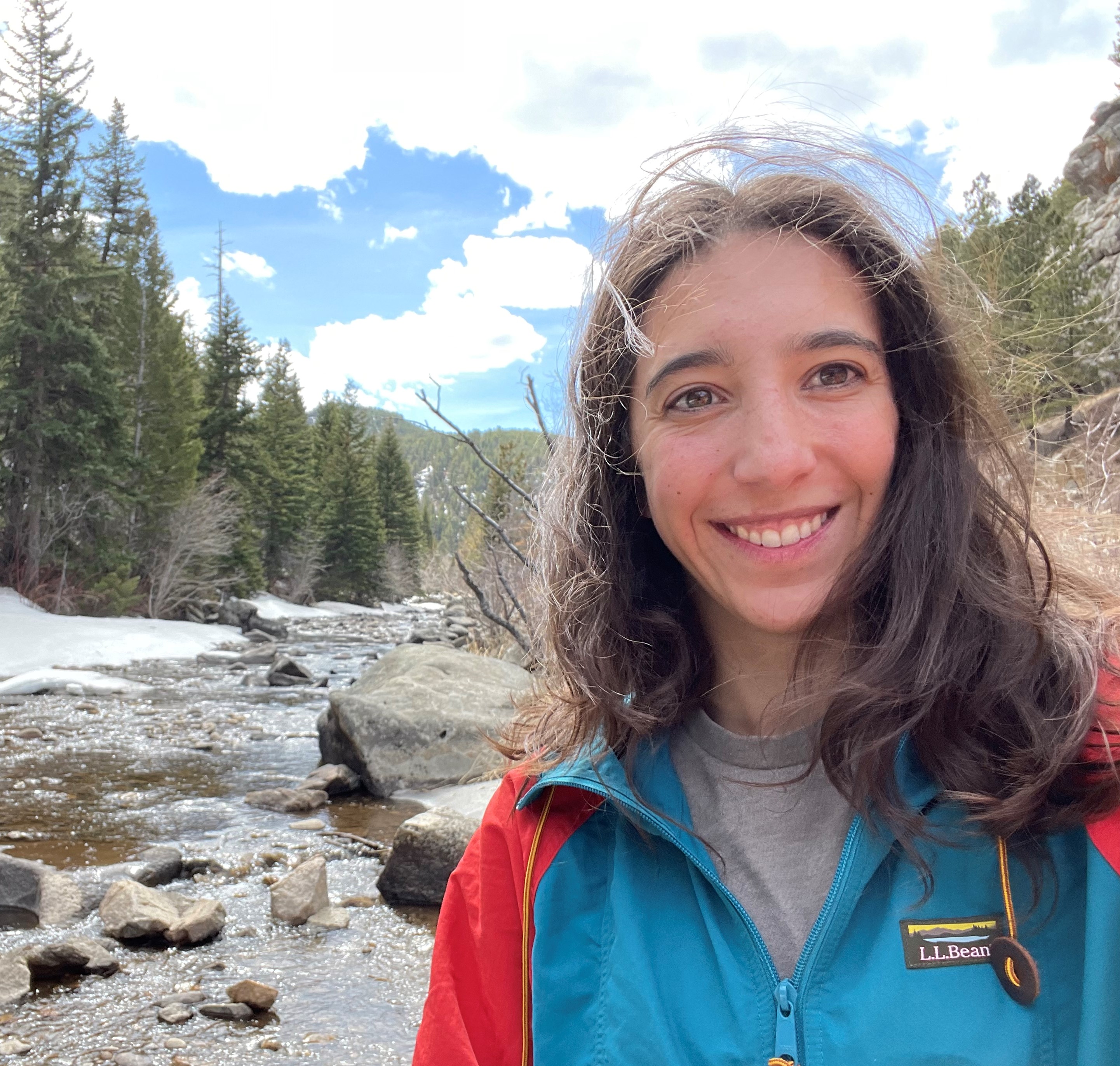
Brianna Corsi is pursuing a master’s degree in Hydraulic Engineering at CSU. She completed a bachelor’s degree in Environmental Engineering at CSU in 2017 before starting her work as a Hydraulic Engineering Consultant at Ayres Associates in Fort Collins, CO, where she became a licensed PE. She returned to CSU as a graduate student in 2021 to pursue her interest in river mechanics, sediment transport, and riverine ecology.

Brianna is teaming with Chelsey Radobenko to evaluate geomorphic changes within the Bernalillo Reach of the Middle Rio Grande, which extends from HWY 550 in Bernalillo downstream to Montaño Road in Albuquerque. The goal of the project is to relate hydraulic conditions to suitable habitat for the endangered Rio Grande Silvery Minnow and to evaluate changes in habitat availability over time. As part of their research, Brianna and Chelsey are using historical aerial imagery and topographic data to develop a 1D hydraulic model using HEC-RAS. Results from the model are then exported into ArcGIS Pro to spatially evaluate habitat availability for each of the minnow’s life stages.


top
  Susan Cundiff
Susan and her family

Susan Cundiff

M.S. in 2019 - Technical Report
Hydraulic Engineering


Research:

Channel Subsidence Modeling in California

Watershed California

Susan received her B.S. in Food, Agricultural and Biological Engineering from The Ohio State University in 2005. In 2006 she began working for Mussetter Engineering Inc., now Tetra Tech, in Fort Collins, Colorado. She has been working part-time towards completing her M.S. in Hydraulic Engineering under Dr. Julien at Colorado State University. She was granted her Professional Engineering (PE) license in June 2011. In her free time Susan enjoys running, snow skiing, traveling and spending time with her husband and two feisty sons.
subsidence modeling

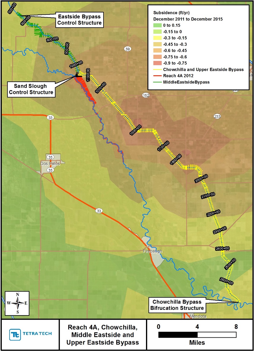
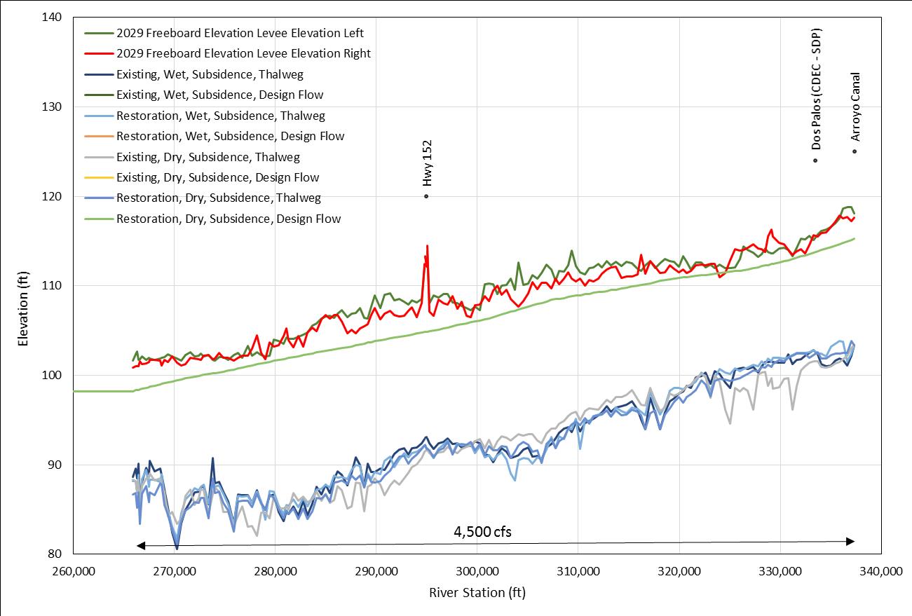
Her work at Tetra Tech has included various modeling tasks on the San Joaquin River in support of the San Joaquin River Restoration Program since 2007. These models include updating one dimensional step backwater models from HEC-2 to HEC-RAS for large scale analyses as well as using RAS 2D and FLOW 3D models for more detailed hydraulic analyses to support the design of structures to improve fish passage. Her most interesting work on the river includes sediment transport modeling using HEC 6T and HEC RAS mobile boundary models considering the impressive amounts of subsidence the SJR experiences. Her research for her Plan B tract of the River Restoration/Hydraulic Engineer M.S. program at CSU is related to the impacts of subsidence on the sediment transport in the San Joaquin River system.


top


Sydney Doidge

M.S. in 2019 - Technical Report
Hydraulic Engineering


Research:  
Hydro-biological analysis of Silvery Minnow habitat of the Middle Rio Grande below San Acacia, NM
 

ArkRiverSlideSydney Doidge is a Hydraulic Engineering Master's student at Colorado State University. She completed her Bachelor's degree in Civil Engineering at Arizona State University in 2018. Sydney's research is focused on understanding morphologic changes on the Middle Rio Grande.


top


John likes taking his son hiking in the mountains.

John England

Ph.D. in 2006 - Dissertation
Hydraulic Engineering

Currently working at the US Hydrologic Hazards U.S. Army Corps of Engineers Risk Management
Center

john.f.england@usace.army.mil

Research:
Distributed Modeling of Extreme Floods and Flood Frequency on Large Watersheds


Refereed Publications:  
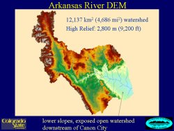
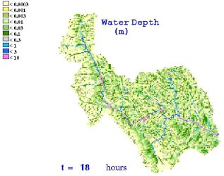
ArkRiverSlide Estimates of extreme floods and probabilities are needed for hydrologic engineering and dam safety risk analysis.  Physically-based, distributed watershed models are used as an avenue to estimate extreme floods, and as a basis to extrapolate frequency curves.  This research focuses on applied hydrology and hydraulics of extreme floods on large watersheds.  The main elements of this Casc2darkwdep18hrfresearch include improving and using a two-dimensional, physically-based rainfall-runoff model (CASC2D) to estimate extr eme floods and probabilities for dam safety on a large (12,000 km2) watershed, the Arkansas River above Pueblo, Colorado.  New tools have been developed, including a channel mesh generator, so the model can be applied at this scale.  The main research goals are to: demonstrate that CASC2D can be used to simulate extreme floods on large watersheds; and add new process components, including extreme storms and initial conditions, so that CASC2D can be used to develop a flood frequency curve.  In addition, we are conducting sensitivity studies to examine: the spatial distribution of storm rainfall with area and elevation; storm duration; initial soil saturation; and channel floodplains; and their effects on the model flood frequency curve extrapolation, hydrograph shape, timing, peak and volume.

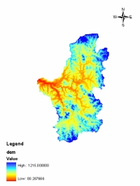
 CASC2D is appropriate for simulating extreme floods and physically-based extrapolations of frequency relationships, combined with a derived distribution approach.  CASC2D can be successfully used to model extreme floods based on observations of extreme rainfall (from both rain gage networks and weather radar) for large watersheds. Images show the Arkansas River Watershed DEM for CASC2D, and predicted water depths for
the watershed. Ongoing research focuses on the storm transposition concept and linkages with radar.  


top


Caitlin Fogarty

M.S. in 2020 - Thesis
Hydraulic Engineering


Research:  
Process-linkage analysis of the Silvery Minnow habitat of the Middle Rio Grande, NM
 

Caitlin is a Master’s student studying hydraulic engineering at Colorado State University. She obtained her Bachelor’s degree in Ecological Engineering from Oregon State University in 2019. She is most interested in a career in stream restoration or river engineering. Caitlin’s research has been focused on determining where critical habitat is along the Rio Grande for an endangered species of fish known as the Silvery Minnow. Currently, her work has focused on assisting with the creation of a process linkage report between Isleta and San Acacia reaches. This report will draw connections between geomorphology, morphodynamics, hydrology, and biology that can be used to define suitable habitat for the Silvery Minnow.


top


Noah Friesen, M.S. Candidate 
  Noah gets out of the desert when he can

Noah Friesen

M.S. in 2007 - Thesis
Hydraulic Engineering

Currently working with Riverside Technology in Fort Collins 

Research:
Analysis of unsteady flow with supercritical velocities in steep channels. 


Refereed Publications:  
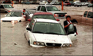
Severe flooding creates havoc for Las Vegas commuters.Noah Friesen is a Masters student in the hydraulics and river mechanics program at CSU. After getting a BS in Civil Engineering in 2005 from CSU, he returned for graduate school in the spring of 2006. He spent the summer of 2006 in Las Vegas, Nevada working at the Desert Research Institute, which is the research branch of the University of Nevada system.

He worked with Dr. Jennifer Duan on a project funded by the Army Corps of Engineers. The Las Vegas valley is extensively urbanized, but has little natural drainage.
Although the region is extremely dry, storms that do occur can be very intense and of short duration. Also, the close proximity of mountains creates alluvial fans that increase the runoff from a storm even more. This results in high discharge, high velocity flows through the city. To help control this flow, a network of concrete drainage channels has been built. These channels are either rectangular or trapezoidal around 3-4 meters wide. The slopes range from 1 to 4 percent. Thus during high flows the flow enters the supercritical regime, with Froude numbers up to 4. The work that he has done is based on a theoretical analysis of unsteady flow at supercritical velocities. Noah is looking at wave height and celerity for different conditions to help draft design guidelines for the construction of the drainage channels. Adding freeboard on top of design flow depths can significantly increase the cost of a channel, and so a more exact idea of how much freeboard is needed would be helpful.

top


  JamesHalgren
James working on TREX-SMA

James Halgren

Ph.D. in 2012 - Dissertation  (30 MB)
Hydraulic Engineering

now at
NOAA-Riverside Technology, inc.
Fort Collins, Colorado


Research:
Multi-event hybrid hydrologic modeling with TREX-SMA


Publications:  

Research: TREX-SMA: A Multi-Event Hybrid Hydrologic Model Applied at California Gulch, Colorado

The TREX overland flow model is limited in temporal scope because no accounting is made for return flow from infiltrated water. James has used techniques from the National
wideRG Weather Service River Forecast System's Sacramento Soil Moisture Accounting (SAC-SMA) program to create a conceptual soil moisture routine for the TREX model. By accounting for the soil moisture recovery and return flows, the new model will bridge the gap between major runoff events and allow for mid- to long-term hydrophysical modeling.

As part of this effort, James is experimenting with different data management and visualization techniques to improve and speed comprehension of the model results.


In other research, James updated a legacy model for use by the Albuquerque office of the U.S. Bureau of Reclamation (USBR) to predict the bed aggradation/degradation response to imposed channel width changes along the Rio Grande. The new model produces animations of longitudinal bed degradation and aggradation. Claudia Leon, a former member of this research group developed the original program using MATLAB 4.0.

With all of his projects, James works to modernize codes, improve organization of data and data access, and create visualizations which reveal details not readily observed from raw data inputs and outputs.

top


  Corinne Horner
Corinne enjoys Grey Rock

Corinne Horner

MS in 2016 - Technical Report
Hydraulic Engineering


Research:

Silvery Minnows of the Rio Grande, NM

Rio Grande
minnows


Corinne Horner is currently a Masters student in Hydraulic Engineering at CSU. She completed her Bachelor’s degree in Environmental Engineering at University of Portland in 2015. She is primarily interested in the intersection of ecology and engineering in riverine ecosystems and river restoration. Corinne’s research is currently focused on the suitability of aquatic habitat within the Middle Rio Grande for the remaining populations of the Rio Grande silvery minnow. Her goal is to develop, test, and apply an index of suitability in order to pinpoint the areas within the Escondida reach the Rio Grande silvery minnow have the highest chance of survival. In her free time, Corinne is an avid rock climber and outdoor enthusiast.


top


Un Ji 
  Dr. Un Ji with P.Y. Julien and Four Major River Restoration Minister Myung-Pil Shim at Ipo Weir, South Korea,  in 2012

Un Ji

Ph.D.  in 2006  - Dissertation
Hydraulic Engineering

Currently at the Korea Institute of Construction Technology
jiuncivil@gmail.com


Research:
Sediment flushing at the Nakdong River Estuary Barrage, South Korea


Refereed Publications:  

U
unjimapn Ji was a PhD student of the hydraulic engineering program in Civil Engineering at Colorado State University (CSU) and she came from Korea. She graduated from Myoungji University in Korea with a BS and MS degrees in Civil and Environment Engineering. In Korea, she worked for several research projects, during the graduate course, such as the experimental and numerical studies and field works related to hydraulics, hydrology and water management. Also, she has been studying the sediment transport, river mechanics, river rehabilitation, fluvial geomorphology etc in the hydraulic engineering program at CSU.
 

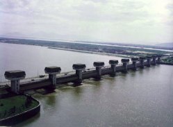
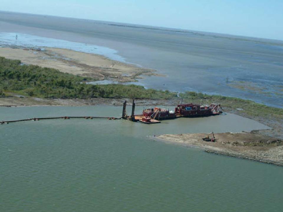
The Nakdong River in South Korea has a basin area of 23,326 km2 and the estuary barrage is located at the end of the river to reduce salt-waterNakdong intrusion in the estuary and prevent a large flood due to high tides. The channel of Nakdong River was designed to convey a design flood of 18,300 cubic meters per second. The estuary barrage impacts the Lower Nakdong River in the following fields: hydraulics, hydrology, sedimentation, water-quality and stream ecology. Especially, because of the construction of the barrage, the Lower Nakdong River has experienced sedimentation problems requiring dredging operation annually. The primary purpose of the dredging operations is to maintain the conveyance capacity of the channel in the event of a large flood combined with high water levels during high tides. The recent historical record shows dredging volumes of about 400,000 cubic meters of dredged material per year. The material dredged is primarily non-cohesive very fine sand.

Un Ji has been working for the computer modeling to evaluate the sedime
nt depositions on the upstream of the estuary barrage and determine the flushing time and the possible lowering of water levels at the barrage to remove the sediment deposition without dredging operation. The computer model is a one-dimensional unsteady flow and sediment transport model. 


top


  DK
DK likes long walks on the beach and listening to soft rock classics.

Do Hyuk Kang

M.S. in 2005 - Thesis
Hydraulic Engineering


Research:

Snow Hydrology Modeling with CASC2D

energybalance
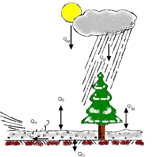
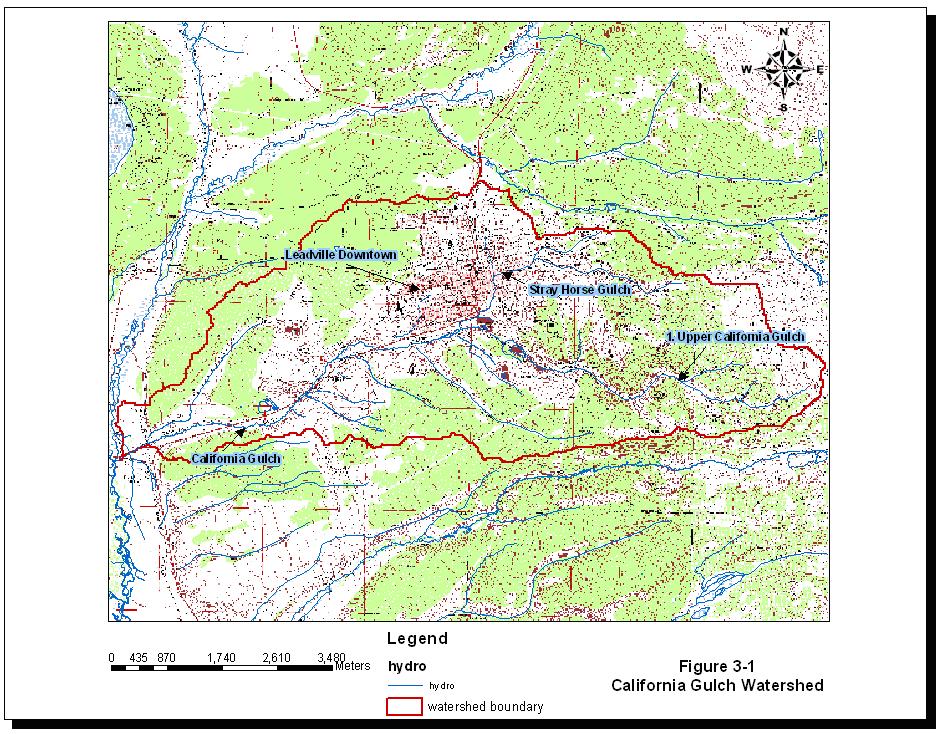
calgulchCASC2D framework has been developed since 1991 by Dr. Julien and his students. CASC2D is the numerical integrated surface hydrology and sedimentation program. Additionally, it can provide the runoff and sediment transport movies with time series.

My focus area is the snowmelt processes in watershed. So, I am developing the snowmelt algorithms based on energy and mass balance equations, and add it into CASC2D framework. I will show hourly, daily, and monthly snowmelt processes in California Gulch. California Gulch in Leadville, CO has been hard mining area. Furthermore, California Gulch has the significant runoff during snow melting season. The goal of my research and thesis will to represent snowmelt procedure in California Gulch, and compare the simulated hydrographs with the measured hydrograph. Master thesis will be done at the end of July about the watershed snowmelt modeling in CASC2D.  

top


  Woochul Kang

Woochul Kang

Ph.D. in 2019 - Dissertation
Hydraulic Engineering

Research:

Sediment yield from ungauged watersheds in Korea

Refereed Publications:  
Woochul photo1
Woochul photo2
I am a Ph.D. candidate in Civil Engineering, and I got a masters degree at CSU in 2014. (“Reactive transport modeling of nutrients in arctic tundra streams”)
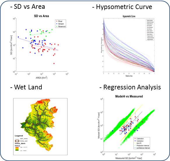
I did a project funded by K-water from Korea . The goal of the project was estimating the sediment yield for ungauged watersheds in Korea. My dissertation is developed from Korean project and it is focusing on relationship between Specific Degradation (SD) and watershed characteristics with GIS analysis. Specifically, the SDs (with MEP and FD-SRC) from stream are relatively higher than one of river. It suggests that upland erosion occurs in the upstream watershed and the sedimentation is deposited during transfer to downstream. Various watershed characteristics (hypsometric analysis, flood plain analysis, regression analysis) are considered to explain this result.


top


Hwa Young with his wife Ho Seun and their son Charlie 
 

Hwa Young Kim

Ph.D.  in 2016  - Dissertation
Hydraulic Engineering


Research:
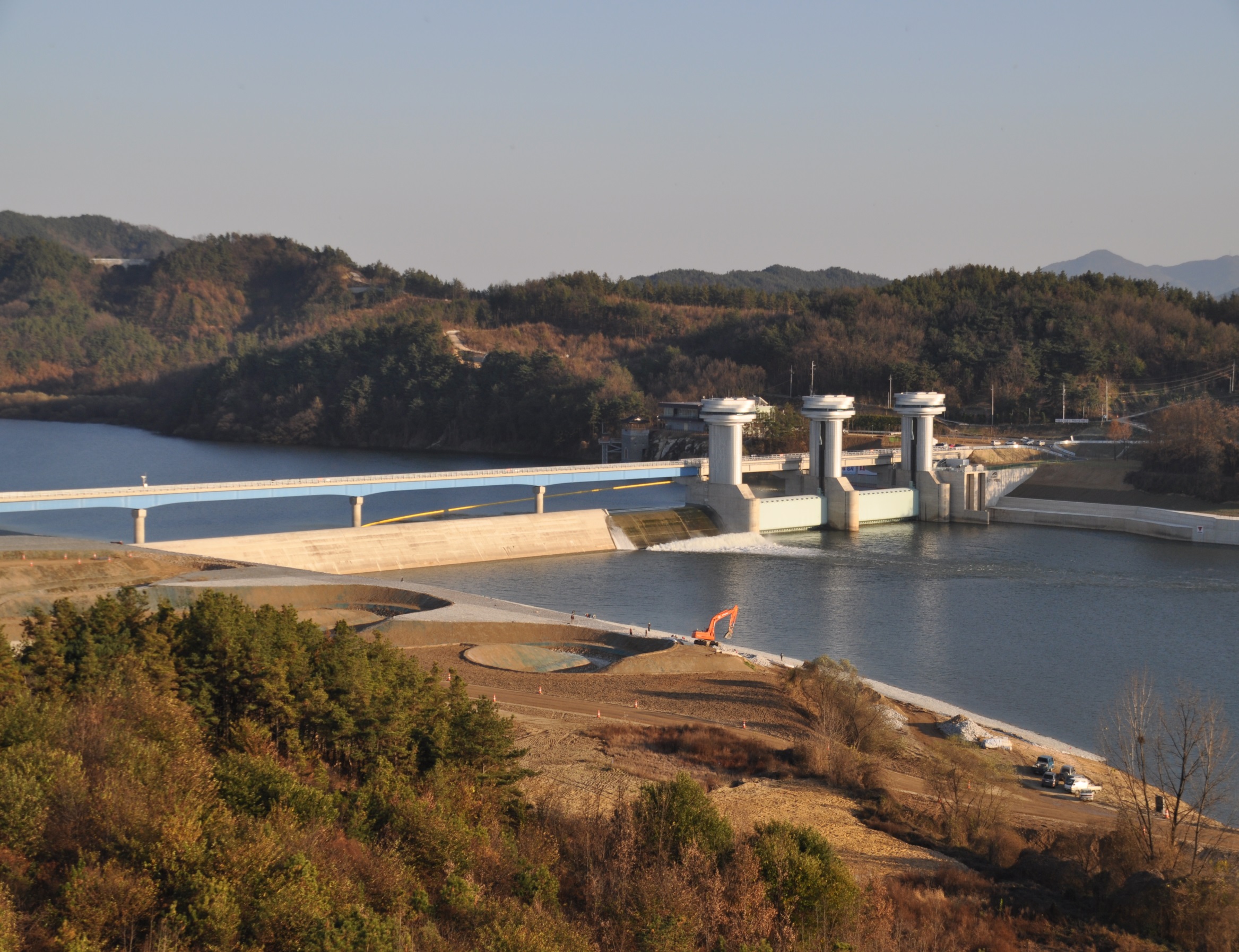
Optimization of Sangju Weir operations in view of erosion and sedimentation problems.

Refereed Publications:  
Hwayoung Kim is a graduate student of hydraulics in Civil and Environmental Engineering Department at Colorado State University. He is currently working on a doctoral program with Dr. Julien since 2013 and has more than 20 years of civil and environmental engineering experiences. He has worked for Korea Water Resources Corporation (K-water). Since he joined in K-water, he has had various engineering experiences such as planning and managing of Four River Restoration Project, operation and management of the multipurpose dam and weirs, and investigation and planning of water resources, etc. In addition, he had experiences related in water supply, he attended and managed planning, construction, operating and maintenance of block system (or Smart Water Grid) in water supply system. During his works, he especially developed a valve and had a patent on a new device; “Vertical type Snap Tap with saddle for water works (in 2008, Korea)”; which is related on water works. And he received The President Achievement Award for the development of riverside in 2011.

Dissertation Research: Optim
ization of Sangju weir Operation with viewpoint on the erosion and sedimentation problems.
Hwayoung is interested in the optimization of reservoir operation with erosion and sediment issues. The Korean government completed the Four River Restoration Project (FRRP, 2009~2013) in which 16 weirs and three multipurpose dams were constructed. However, after construction, erosion and sedimentation problems have been taking place upstream and downstream of some hydraulic structures. The sedimentation problem is one of the most interesting topics for government engineers because they have to allocate the dredging budget required for river management. R
esearchers and engineers in Korea have been trying to find countermeasure for these problems.
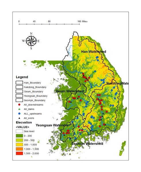
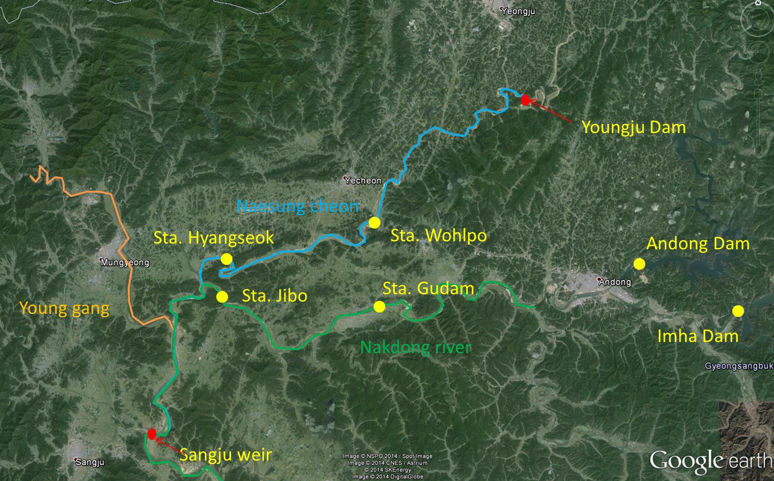
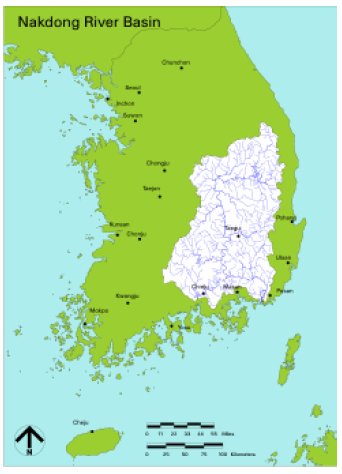
Hwayoung is trying to apply optimization techniques like the Multi-Criteria Decision Analysis (MCDA), in addition to traditional reservoir sedimentation methods. He selected the  Sangju weir basin as a research area which is located in the upper part of the Nakdong river basin in Korea. His research area includes three main tributaries, Naesung-cheon, Young-gang and Nakdong-River, including three multipurpose dams, Andong, Imha and Youngju multipurpose dam, and it has 7,407km2 of drainage area. Through this research, he seeks to find an optimal solution for the management of erosion and sedimentation problems.

top

Hyeonsik Kim, Ph.D. Candidate 
  Hyeonsik appreciating the beauty of Colorado

Hyeonsik Kim

M.S.  in 2006 - Thesis
Hydraulic Engineering
Ph.D.
Dissertation National Chungbuk University

Currently working for K-Water on the large Kyongin-ARA Waterway Project

Research:
Soil Erosion Mapping of the Imha Watershed

Refereed Publications:  

Journal of Hydraulic Turbid waters in Banbyeon Stream, inflow to Imha DamImha Multi-purpose Dam, South KoreaHyeon-sik Kim is a graduate student of the hydraulic engineering program in Civil Engineering at Colorado State University (CSU). He completed his MS in 2006. He came from South Korea and graduated from Chonnam National University, Kwangju in 1992 with a BS in Civil Engineering. He has been working for Korea Water Resources Corporation (KOWACO), which is establishing an integrated water management system focused on water utilization and flood control. In KOWACO, He worked on various flood control, multi-purpose dam management, Investigation project of river basin, and hydrology and hydraulics research projects.  He is a Licensed Professional Engineer in South Korea. He is interested in stream rehabilitation and sediment transport

The Imha Multi-purpose Dam, constructed at 18 km upper point from the start of Banbyeon stream, which is the first tributary stream of the Nakdong River, is a rockfill type dam that is 73 m in height, 1,361 ㎢ in catchment area and has a storage capacity of 595 million ㎥ with a flood control capacity of 80 million ㎥. The construction of this Dam began in December 1984 and was completed 7 years and 6 months later in May 1992. Imha dam has some problem, which is the inflow of turbid water in reservoir, since it’s construction. Especially, Nephelometric Turbidity Units (NTU) in Imha reservoir increased dramatically by the typhoons “RUSA” in 2002 and “MAEMI” in 2003. The maximum NTU is recorded by 1221 in 2003.

Hyeon Sik will take the analysis of the Soil Loss quantity in Imha watershed using the Revised Universal Soil Loss Equation (RUSLE). He will look at the causes and alternatives of the turbid water in this area.  
top


Jaehoon Kim, Ph.D. Candidate
Jaehoon Kim and his young daughter

Jaehoon Kim

Ph.D. in 2012 - Dissertation
Hydraulic Engineering


Research :
Debris Flow Hazards in South Korea


Refereed Publications:  

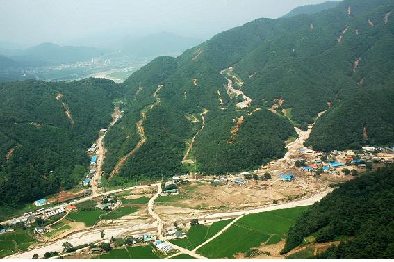
Debris flow in Youngchon, South KoreaIn South Korea, rainstorm patterns are rather unique with short duration and very high intensity.  Landslides or debris flows in mountainous areSoil porosity and slope relationships for modeling soil fluid capacityas due to heavy rainfall tend to increase.  During the past 10 years, typhoons Rusa (2002) and Maemi (2003) and series of rainfalls on July (2006) severely impacted the Korean peninsula.  The daily maximum rainfall in 2002, 2003, and 2006 were 870.5 mm, 289.5 mm, and 255.5 mm respectively.  The amount of damage in 2002, 2003, and 2006 was 5.1 billion dollars, 4.2 billion dollars, and 1.8 billion dollars and the number of people dead for each year were 246, 131, and 52 respectively.
 
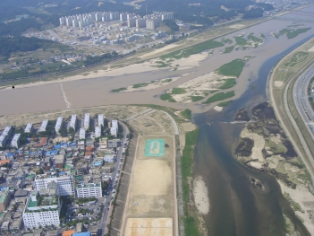
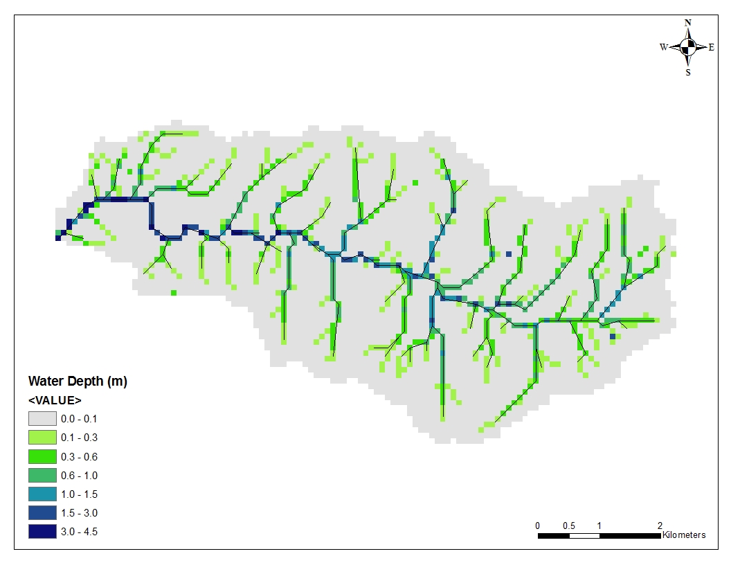
 The research on disaster prevention needs to be developed further in South Korea.  The new computer modeling technology for extreme flood will be very beneficial to the people of South Korea.  The modeling picture using TREX (Two-Dimensional Runoff Erosion and Export) shows the predicted water depth in Inje area in Gangwon-do.  
            Jaehoon Kim completed BS and MS degrees in Forest Resources at Yeungnam University.  He is studying in computer modeling of TREX to evaluate the runoff and sediment depositions on mountainous stream area.


top


Nick Koutsunis 
  Nick enjoys mountain biking in Colorado

Nick Koutsunis

M.S. in 2015 - Technical Report
Hydraulic Engineering


Research:

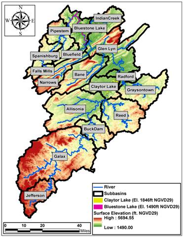
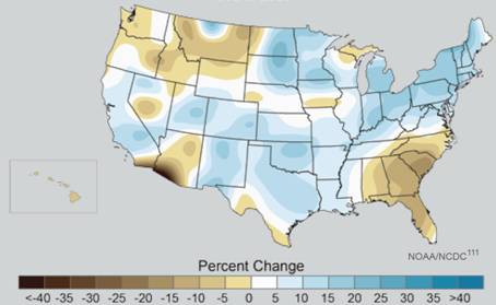
Climate change issues and PMP-PMF simulations at Bluestone Reservoir


Bluestone Dam WatershedMap of potential climate change South KoreaNick Koutsunis is a Hydraulic Engineering Master's student at Colorado State University

 Climate change has moved to the forefront of conversation in recent years. Nick is studying the impact of climatic changes on downstream hydraulic geometry and its influence on flood hydrograph routings.  To complete this analysis, Nick analyzed the Julien-Wargadalam equations with respect to the expected future increase in dominant discharge as a result of climate change.  These relationships were then applied to the Muskingum-Cunge hydrologic routing method.  Application was made to the Bluestone Dam watershed to determine the impact that these changes would have on the routing of the Inflow Design Flood.


.
top


Kristin LaForge


M.S. in 2018 - Technical Report
Hydraulic Engineering


Research:

Silvery Minnow Habitat and River Mechanics in the Rio Grande, NM


Kristin LaForge is pursuing her Master’s degree in Hydraulic Engineering at CSU. She completed her Bachelor’s degree in Biology in California at Cal Poly San Luis Obispo in 2013. She is interested in how the mechanics of rivers interact with the health of riparian ecosystems and fish habitat.

Kristin’s research is focused on using aerial photography to analyze silvery minnow habitat to see how it changes temporally and spatially throughout the Middle Rio Grande. Subreaches within the study area can be compared over time by attributing habitat quality scores to different habitat types such as shoreline complexity, backwater, and side channels. This analysis can provide insight into what types of habitats silvery minnows survive best in.


top

Jaehoon Kim, Ph.D. Candidate
Kennard and his dog "Lucky"

Kennard Lai

MS in 2016 - Technical Report
Hydraulic Engineering


Research :
Hydraulic geometry changes in Malaysia


Refereed Publications:  

Kennard is currently a Masters student pursuing his degree in Hydraulic Engineering. Originally from Kuala Lumpur, Malaysia, Kennard obtained his undergraduate degree in Environmental Science from Iowa State University in May 2012. He is interested in environmental river mechanics, flood and stormwater management. During Summer of 2015, Kennard obtained an internship with Larimer County Engineering Department. He is also an active member of Engineers without Borders and American Society of Civil Engineers (ASCE) here at CSU. During his free time, he spends time with his dog and enjoys the outdoors.

Kennard's research interest is in the Flood management of Klang River watershed in Malaysia, particularly the effects of the SMART Tunnel outflow on the Kerayong River. The Klang River watershed is where Kuala Lumpur, Malaysia's capital city is located and is highly affected by urbanization and development. The low lying region combined with tropical monsoon and land use changes, the watershed undergoes a shift in time of concentration, increasing the risk of flooding. The alleviate flooding, the city constructed the Stormwater Management and Roadway Tunnel, a dual purpose tunnel to divert stormwater away from the critical areas to the outlet, which is the Kerayong River. Kennard will be conducting a hydraulic analysis of the effects of the stormwater discharge on the downstream portion of the Kerayong by modeling the river using HEC-RAS during storm events. He will be analyzing the water surface profile, channel discharge and their effect on the channel morphology.


top
Susan Novak, M.S. Candidate (and Millie)
Amanda at the San Acacia diversion dam on the middle Rio Grande in New Mexico.

Amanda Larsen

M.S.  in 2007 - Thesis
Hydraulic Engineering


Research:

Hydraulic Analysis of the Escondida Reach of the Middle Rio Grande River,NM

Amanda completed her masters degree in hydraulics.  She is originally from Tea, SD and received her undergraduate degree from the University of Nebraska-Lincoln Rio Grande river near Socorro, NM.in May of 2006.  After years of living on the plains, her favorite part about living in Colorado is seeing the mountains every day. 

Hydraulic Modeling Analysis
Channelization and dams placed along the middle Rio Grande River have caused changes in the morphology of the river.  An understanding of the historic and predicted future conditions on the river is important for continued maintenance of the river by the Bureau of Reclamation.  The Bureau of Reclamation office in Albuquerque, NM has commissioned a number of studies along the middle Rio Grande River to aid in understanding and maintenance of the river.  

The study reach is 19-miles long and stretches from Escondida, NM to San Antonio, NM.  Changes is channel width, cross-sectional area, mean bed elevation, water surface elevation, sinuosity, width/depth ratio, planform geometry, discharge, suspended sediment, etc. will be evaluated using programs such as ArcGIS, HEC-RAS, GeoTool, as well as other programs.  Equilibrium conditions for slope and width will also be predicted using a variety of methods.  

An analysis of the floodplain and bedforms present in the reach was added to this report.  The location and degree of inundation of the floodplain will be evaluated using aerial photography and HEC-RAS.  An inventory of historic bedforms will be compiled and cjiuncivil@gmail.comompared with predictions based on channel and flow characteristics.  
top


Weimin Li, Ph.D. Candidate 

Weimin Li

Ph.D. Candidate
Hydraulic Engineering


Research :
Alluvial River and Aquatic Habitat Modeling of the Rio Grande, NM
Weimin earned his MS in Hydrologic Science and Engineering at CSU.  He worked as technical hydrologist at the Idaho Department of Water Resources.  Upon return to CSU for a PhD degree in Hydraulic Engineering, he is interested in developing 2-D and 3-D computer models for the analysis of river processes, alluvial river deformation and river restoration for aquatic species.  He is doing numerical simulations of river flow and sediment transport on the Rio Grande in New Mexico.  He likes to play badminton.  Often he walks and rides his bike with his family on Poudre trail in Fort Collins.  


top


Kyoungmo with his family near Aspen Colorado.

Kyoungmo Lim

Ph.D. Candidate
Hydraulic Engineering


Research: 

Typhoon Surge Propagation Modeling along the Lower Nakdong River, South Korea.

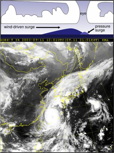
Typhoon Maemi and graphic illustrating storm surge

Kyoung-mo Lim is a graduate student of hydraulics in Civil Engineering at Colorado State University. He is currently here working on a doctoral program. Prior to attending CSU he spent 8 years working as a public officer. He worked on the long term master plan of Busan City in Korea, which included the task of preventing disasters and managing land use adjustment. He also managed to build various structures in this urban area. Even though he was unfamiliar with hydraulics and had trouble studying it, taking part in such a program will be regarded as a good chance for him to deal with something related to rivers.

 He is interested in the typhoon surge propagation along the river. Many researchers focused on the effect of typhoon surges on coastal areas where water runs-up and encroaches upon a breakwater. However there are few documents about the effect of surges on the upper river. The storm surge intruded upstream and elicited an abrupt water level change in the lower river. Meanwhile the typhoon surge was offset as it propagated upstream because of the river discharge caused by rainfall. Busan, a bustling city of approximately 3.7 million residents, is the second largest city in Korea. The Nakdong River penetrates western Busan City and the high levee was constructed to prevent floods from overflowing and submerging nearby areas. The Lower Nakdong River has very a mild slope and the surge easily traveled upstream from the river mouth. The numerical modeling was conducted considering two important factors, river discharge and surge height. Three different models were used to fully describe the surge propagation: KORDI-S (2D FDM), RMA2 (2D FEM) and FLDWAV or HEC-RAS (1D).The modeling experienced the calibration and verification by comparing the measured data. The severe typhoon surge accompanied by a rise in sea level and global warming was simulated to check the levee and other hydraulic structures in Lower Nakdong River. To investigate the water motion and salt material in detail, more observed data and 3D modeling could be required.     


top


Jazuri Abdullah, Ph.D. Candidate 

Nur Shazwani Muhammad

Ph.D. in 2013  - Dissertation
Hydraulic Engineering


Research:
Analysis of the probabilistic structure of monsoon precipitation in Malaysia 

shazwani1

 
Nur Shazwani Muhammad is a lecturer at the Faculty of Engineering and Built Environment, National University of Malaysia (UKM). She started her career as an Environmental Engineer at Dr. Nik and Associates Sdn. Bhd. in October 2002 after completing her degree in Environmental Engineering from University of Malaya. In 2005, she completed her Masters degree in Water Engineering from Cardiff University, United Kingdom. She joined Universiti Teknologi MARA as a lecturer in February 2006 and served for more than 3 years. Joined UKM as a lecturer in April 2008.

 Her dissertation will concentrate on the stochastic analysis of monsoon precipitation in Malaysia. The northeast monsoon from November to March brings moisture and a lot of rain to Southeast Asia, while the southwest monsoon from May to September brings dry air to the area. April and October are transitional months, which results in considerable amount of rain in these months. Considering the tropical climate in Malaysia, predicting the probability of rain is an important parameter in water resources management and flood prediction. Additionally, the research will also consider spatial variability of rainfall in Peninsular Malaysia. The ultimate goal of the research is to prove that the rainfall events during monsoon seasons are not independent from one event to another, and to develop an algorithm and technology to calculate the probability of rainfall and predicting the amount of rainfall during monsoon months.


top


C:\Documents and Settings\b0etepso\Local Settings\Temporary Internet Files\Content.Word\MSH_09_20_2007_207[1].jpg
Olga enjoys the outdoors near running waters.

Olga Martyusheva

M.S. in Fall 2014 - Technical Report
Hydraulic Engineering


Research:
Smart water grids


Publications:

Olga Martyusheva obtained her Bachelor of Science degree in Civil Engineering in May 2013 from Washington State University. The topic of the technical report is on Smart Water  Grids. The total availability of water resources is currently under stress due to climatic changes, and continuous increase  in  water demand linked to the global population increase.  A Smart Water Grid is a two-way real time network with sensors and devices that continuously and remotely monitor the water distribution system. Smart water meters can monitor many different parameters such as pressure, quality, flow rates, temperature, and others. Current distribution systems have large leakage rates. However, Smart Water Grids cannot  substitute for basic water infrastructure. The interface of Smart Water Grids with natural systems such as rivers, lakes, and  reservoirs is also a key component of a “smart” approach to the use of water resources.  These natural components are subjected to climate variability and single events can disrupt daily operations. Deep understanding of the network vulnerability and preparedness for disaster prevention may also contribute to the “smart” reputation of water distribution systems.

top


Patrick Ndolo Goy

M.S.  in 2015 -   Thesis
Hydraulic Engineering


Research:

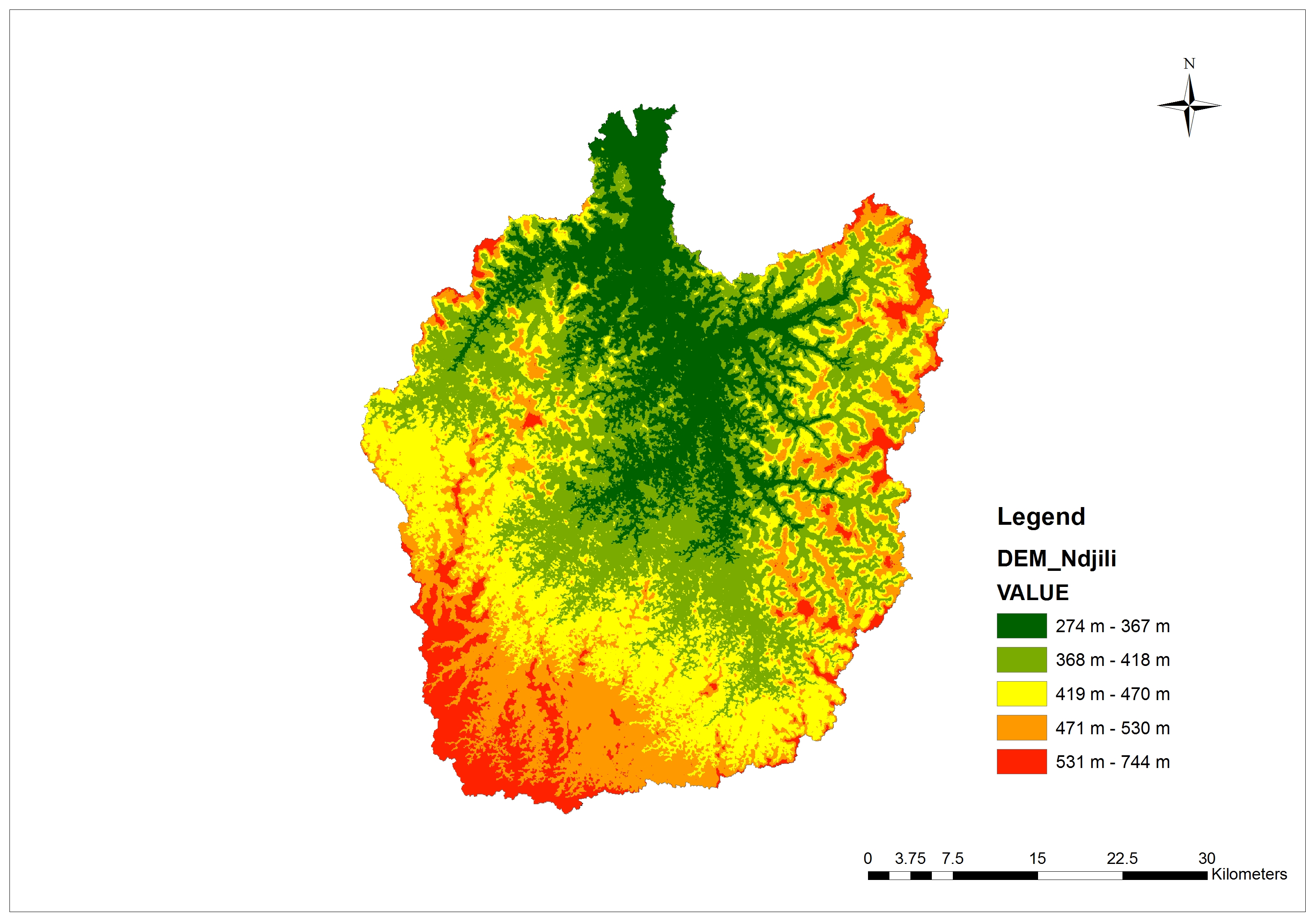
Increase in turbidity of the N'djili river basin in Congo

Patrick Ndolo Goy received his bachelor degree in Civil Engineering with distinction from the University of Kinshasa, DR Congo, in 2006. After he graduated, he was appointed deputy chief of staff of the Materials and Soil Mechanics laboratory of the University of Kinshasa for which he conducted more than one hundred major geotechnical studies in DR Congo, Rep. of Congo, and Burundi. From 2009 to 2012, he helped teach 3 classes as Teaching Assistant (Soil mechanics, hydrology and hydraulic classes). As member of the Nile Basin Initiative Network for DR Congo, Patrick was involved in the implementation of the Decision Support System of the Nile Basin between 2008 and 2011. He was awarded a Fulbright Scholarship from State Department in 2013 to complete a Master’s degree in Hydraulics and River Mechanics at Colorado State University. After completing his Master’s degree, Patrick is planning in enrolling in PhD program in Hydraulic engineering.

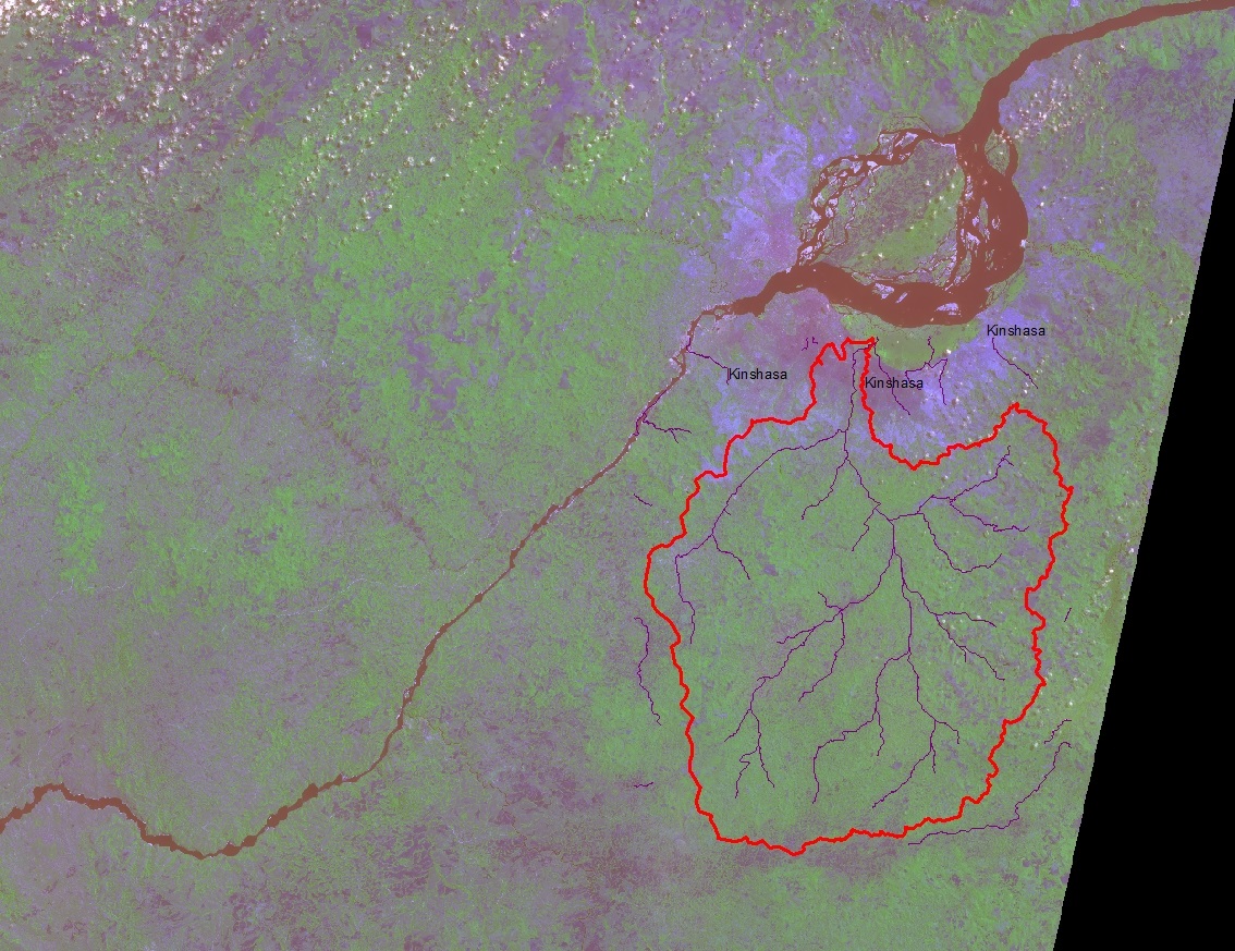
The N’djili River basin (2,097 km2) which provides about 60% of the drinking water demand of the Kinshasa City (Dem. Rep. of Congo) faces increasing watershed degradation from agricultural practices like burning, informal settlements and vegetation clearance resulting in increasing of  suspended sediment load in the N’djili River for the last three decades. My research seeks to understand the effects of land use/cover changes on erosion, sediment yield and the turbidity for the N’djili River Basin. The Revised Universal Soil Loss Equation model has been implemented in an ArcGIS based framework to: (1) predict the annual average soil loss rate at the basin scale; (2) map the soil erosion rates on the entire basin for different land cover and land use scenarios; (3) estimate the sediment delivery ratio and the sediment yield at the water intake of the N’djili water treatment plant; (4) assess the impact of wildfire on the turbidity of the N’djili River; and suggest Best Management Practices for the land use to reduce the total suspended solid rate to acceptable level in the N’djili river basin in order to reduce considerable economic losses due to the disruption of water utility operations and the high cost of chemical water treatment.


top


Susan Novak, M.S. Candidate (and Millie)
Susan is a Gemini who enjoys kayaking, sushi, and playing with her greyhound, Millie.

Susan J. Novak

M.S.  in  2006 -   Thesis
Hydraulic Engineering


Colorado State University


Research:
Geomorphology of the Cochiti Dam Reach of the Middle Rio Grande River, NM

Middle Rio Grande Database
The Rio Grande Database was compiled as part of the work of PhD. Student, Claudia Leon in her study of the Middle Rio Grande in 1998. The database consists of measurements of discharge data, channel characteristics, and sediment data for the bed and water. The data for this project was obtained through the USGS and USBR and was used in numerous Hydraulic Modeling reports written for the USBR by CSU graduate students.  The reach under analysis stretched from Cochiti Dam to the San Acacia Diversion Dam.    This area is still under study for biological, hydrological, and geological changes. 

Cochiti Dam Rio Grande near San Acacia, NM    The purpose of this project was to update this database with the most recent possible data, using sources such as the U.S. Bureau of Reclamation office, U. S. Geological Survey, and the USBR reports. The data, analyses for each reach studied in the Middle Rio Grande, and the reports themselves were organized into an interactive database DVD that can be accessed like a webpage. Through this, it is possible to view analyses from each reach of the Rio Grande, each report, and the theses and dissertations written by the students who have worked on this project for the past several years.

Currently working for K-Water in Daejon, South Korea.
Hydraulic Modeling Analysis

    The middle Rio Grande River is one of the most historically studied rivers in the US.  Changes to the river due to the installation of several dams and channelization has led the US Bureau of Reclamation in Albuquerque, NM to commission hydraulicshahfairbank@csupomona.edu summaries of several reaches in the river.  The reach studied in this analysis is 10-miles long, stretching from Cochiti Dam to Santo Domingo, NM.
    The morphology of this reach is being studied for changes in the cross-section, width, mean bed elevation, water surface elevation, sinuosity, width/depth ratio, planform geometry, discharge, suspended sediment load and concentration, etc.  GIS, HEC-RAS, Geo-Tool, and other programs are being utilized in this study. 
Expected results are similar to those discovered by the other reaches downstream of the dam.  This reach should experience magnified changes, however, since it is immediately downstream of the dam.  The bed will have degraded, armored into a gravel-bed river; the sediment concentration and load will be much smaller now since the dam is releasing nearly clear water.  The width has narrowed and the width/depth ratio has decreased.  Since the dam upstream is controlling the discharge, peak flows have probably been drastically reduced to control flooding.
     This analysis will be finished by the end of the summer with the thesis defense in the fall of 2005.  


top


Aaron working on mine reclamation in Turkey

Aaron Orechwa

M.S. in 2015 - Research Report

 Hydraulic Engineering


Research:
Rehabilitation of an abandoned uranium mine


Aaron received a B.S. in Environmental Resources Engineering at Humboldt State University (HSU) in Arcata, California in Fall 2006. His studies included water quality, water resources, open channel and pressurized hydraulics, building energy resources, salmonid passage fish passage design, and restoration of tidal wetlands. After completing  two geotechnical and environmental engineering internships during his summers in undergrad, he accepted a full time position as an environmental engineer at Tetra Tech in Fort Collins, Colorado and has been a full-time employee since 2006. He has been working part-time towards completing his M.S. in River Restoration under the guidance of Dr. Julien at Colorado State University. He was granted his Professional Engineer (PE) license in June 2011. He manages a number of projects at Tetra Tech involving the remediation and reclamation of abandoned mine lands and radiologically impacted sites. He leads the radiation protection field services group for the company; some of his specialties include: construction oversight, statistics of environmental monitoring, hydrologic and hydraulic modeling, advanced GIS mapping and analysis, geostatistics, characterization of soils using innovative techniques, and radiological site characterization. He has presented at four international conferences on topics including probabilistic distributions of gamma radiation data, statistics of environmental monitoring, radiological site characterization, and characterization of abandoned uranium mines. He is completing his final semester at CSU and expects to graduate in December 2015. In his free time he enjoys disc golf, hiking, scuba diving, and traveling.

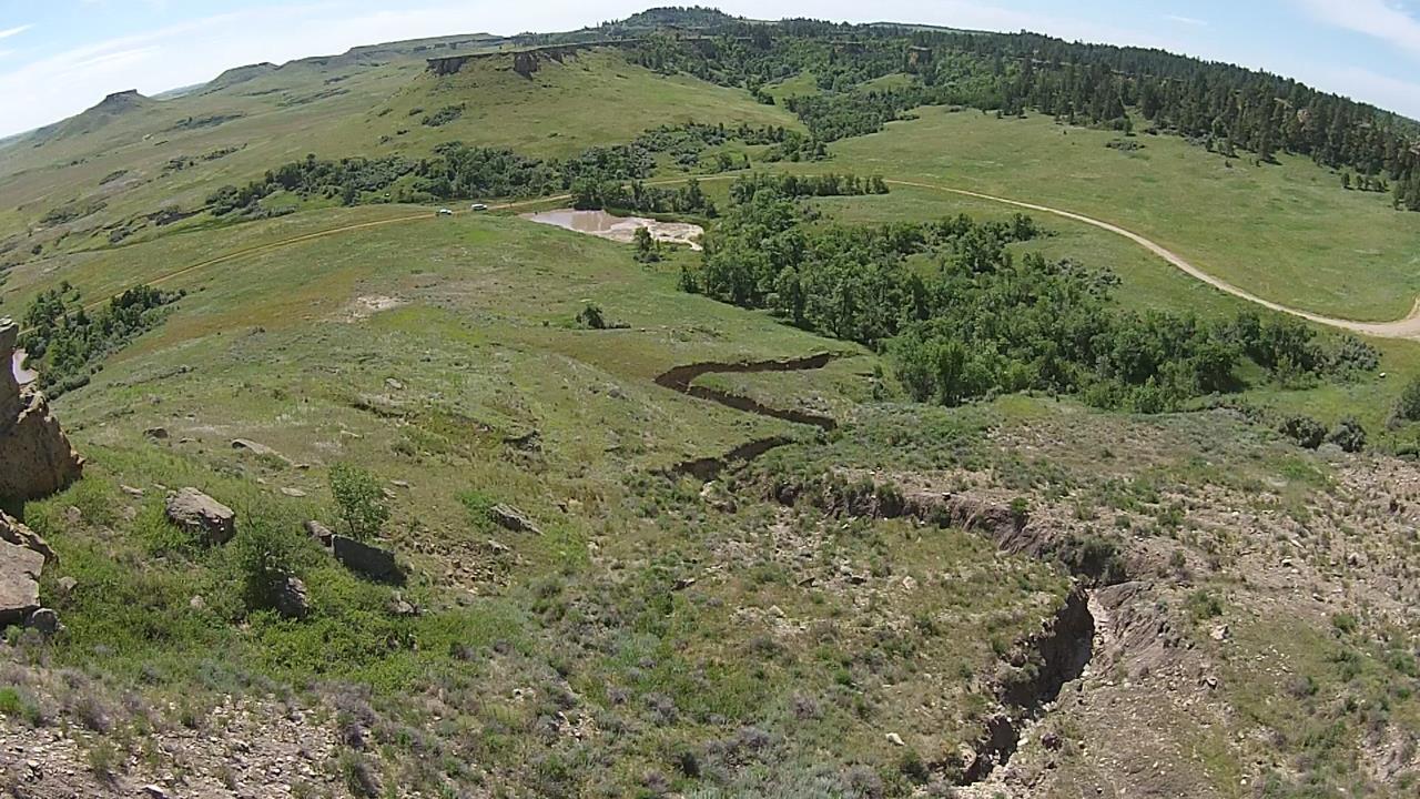
His research under the Plan B tract of the River Restoration/Hydraulic Engineering M.S. program at CSU is related to a project he has been working  on since 2010- the Riley Pass Abandoned Uranium Mine located in the Custer National Forest in Harding County, South Dakota. The US Forest Service is the federal land manager responsible for the cleanup of this site, which is contaminated with heavy metals and radionuclides from Cold War era strip mining. Mr. Orechwa has designed sampling plans and performed numerous sampling trips in order to comprehensively characterize the mine waste for reclamation design. His final research paper consists of a soil contaminant mapping, hydrologic analysis, hydraulic analysis, and soil loss mapping at Riley Pass. The first portion of the research involves characterization of contaminants of concern in surface soils using double sampling in situ measurement techniques.  Utilizing HEC-GeoHMS and HEC-GeoRAS, Aaron is conducting hydrologic and hydraulic analyses on two major watersheds and ephemeral gullies where erosion and sediment transport is a major concern. The results from the hydrologic and hydraulic analysis will be used to map the floodplain for design storm events. Soil loss rates will be estimated over these same areas using a GIS application of the revised universal soil loss equation (RUSLE). Finally, the contamination data and soil loss rates will be used to analyze potential loading of heavy metals and radionuclide being transported from the site.
.

top


C:\Documents and Settings\b0etepso\Local Settings\Temporary Internet Files\Content.Word\MSH_09_20_2007_207[1].jpg 
.
Patrick at the Mt St Helens Crater

Patrick O’Brien

Ph.D. in 2017 - Dissertation

Currently working at the US Army Corps of Engineers, San Francisco District, CA
patrick.s.obrien@usace.army.mil


Research:
Coastal Infrastructure Vulnerability under Global Sea Level Rise: CPRR Framework


Research Focus Areas :

    1. Define a framework for the analysis of coastal infrastructure vulnerability

    2. Develop methodology to cope with climate change and sea level rise. The framework contains:
        a. datum adjustments
        b. total water levels
        c. scenario develpments
        d. performance thresholds and vulnerability assessment
3. Test the framework on different types of structures in different geographic areas

top


Susan Novak, M.S. Candidate (and Millie)
Tracy likes to fish in Colorado

Tracy Owen


MS in 2012 -
Thesis
Hydraulic Engineering


Research:
Hydraulic Analysis of the Elephant Butte Reach of the Middle Rio Grande, NM

Rio Grande near San Acacia, NMTracy is a Masters student at Colorado State University, majoring in Hydraulic Engineering.  She obtained her Bachelor of Science degree in Civil and Environmental Engineering in 2006 from The University of Vermont.Cochiti Dam

Hydraulic Modeling Analysis:

The middle Rio Grande River is one of the most historically studied rivers in the US.  Changes to the river, due to the installation of several dams and channelization, has led the US Bureau of Reclamation in Albuquerque, NM to commission hydraulic summaries of several reaches in the river.  The Elephant Butte Reach, studied by Tracy, is about 30 miles long, stretching from the southern boundary of the Bosque del Apache National Wildlife Refuge to Elephant Butte Reservoir in New Mexico.

HEC-RAS modeling of the reach is being performed using cross-section and planform geometry, flow discharge and hydraulic geometry.  A channel analysis will examine the relationship between hydraulics, hydrology, sediment loads, reservoir levels, and the ensuing effects on a river system like the Rio Grande.  Comparisons will be made between the various years to see if any trends exist.  Elephant Butte Reservoir levels over time will be analyzed, along with historical rates of riverbed aggradation and degradation along the reach.


top


  Marcos Palu
Marcos and his wife Susan in California

Marcos Palu

Ph.D. in 2019  Dissertation
Hydraulic Engineering


Research and Publications: 
Dam Break Flooding of the Doce River in Brazil - model video

Dam Break Brumadinho - video  and mudflow

Sediment propagation in the Doce River after the mine tailings collapse - ASCE paper - Fundao Dam Break

Flood routing algorithms - Doce River

Review of Tailings Dams failures in Brazil

Cambambe Dam in Angola - Conference - Dam Engineering Article

Campinas Conference


Marcos Palu is currently a PhD student in Civil Engineering at CSU. He received his Bachelor’s in civil engineering and Master’s degree in hydraulic engineering from Federal University of Paraná in Brazil. He has experience with design of hydropower plants and hydraulic structures in Brazil and other countries. He is a researcher from the National Council for Scientific and Technological Development (CNPq) Brazil.

His research is related with the flood wave caused by the failure of the tailings dam. He is studying the flow features and the hyperconcentrations effects in Doce River in Brazil, caused by the Fundão Tailings Dam failure in November of 2015.


top

hello
Kiyoung and his Family

Kiyoung Park

Ph.D. in 2013  - Dissertation
Hydraulic Engineering


Research: 
Analysis of Sediment Plugs in Alluvial Rivers 
 

Hapcheon Dam near Jin Joo, South KoreaKiyoung Park is a graduate student of hydraulics in Civil Engineering at Colorado State University. He is currently studying  PhD in hydraulics. After graduating from Kyongbuk National University in 1997, he has been working for Korea Water Resources Corporation (K-water). In Kwater, he operated 16 multi-purpose and 14 water supply dams from the Water Resources Operations Center(WROC)  which is the only specialized water management organization in Korea.Map of Nakdong River Basin, South Korea

   He is interested in the causes and counter-measures of channel plugs in alluvial rivers. In the past, several plugs occurred around Bosque del Apache Reach in the Middle Rio Grande River, NM and resulted in water-supply and wild-life habitat problems. Through his research, he is finding out the complicated plug formation mechanism and sustainable plug alleviation measures, such as channel widening and installing river flow-control structures. 

 As the 4 Major Rivers Restoration Project is going on in Korea and his department (WROC) has responsibility to operate and manage the newly-built 16 weirs after the project, he think it’s so fortunate to apply his research to operating the weirs optimally so that prevent unexpected river plugs, aggradation and degradation. 

top


  seema
Shukran enjoys Horsetooth Reservoir near Fort Collins

Shukran Sahaar

M.S. in  Fall 2013 -  Thesis
Hydraulic Engineering


Research: 
Soil Erosion Modeling Using RUSLE & GIS on Kabul (Indus) Basin, Afghanista

Debris flow video in Afghanistan

Report on riverbank erosion for KICT


Shukran Sahaar worked with US Army Corps of Engineering (USACE) branch called Afghanistan Engineering District (AED) in Afghanistan on Streamflow Characteristics of Rivers in Southeastern Afghanistan during years 2009-2010.  He also worked with National Military Academy of Afghanistan as an Assistant Professor --Hydrology and Hydraulic classes-- (2010 -2011). He was awarded a Fulbright Scholarship from State Department in year 2011.   

Environmental assessments shows environmental degradation such as cutting forest trees as fuel wood, poor grazing practices and  transformation from an agricultural area to open land for residential purposes.  My study area is the Kabul (Indus) Basin, one of the five major basins in Afghanistan with catchment area of   and elevation variation of 380 to 6080m.  The Kabul (Indus) basin covers 12 percent of the national territory but alone it drains one fourth of (26 percent) of the total annual water flow of Afghanistan. 
My research is based on soil erosion modeling for watershed programs and hydropower development projects at southeastern region of Afghanistan.  My thesis will present results of ArcGIS-based mapping of the mean annual soil loss rate using the RUSLE model.  The results of the thesis will be beneficial for sediment migration plan to solve the sedimentation problem of existing and proposed reservoirs. 


top


Jon looks for shade during summers

Jon Rainwater

M.S. in Spring 2014 -  Technical Report
Hydraulic Engineering


Research:

Sediment Plug Formation Hypotheses for the Middle Rio Grande,NM

Jon Rainwater obtained his Bachelor of Arts degree in Civil Engineering in May 2012 from Carroll CollegeRio Grande river near Socorro, NM. in Helena, Montana.  While obtaining his bachelor’s degree he worked for the Federal Highway Administration for almost two years.

Hydraulic Modeling Analysis
He is studying the middle Rio Grande River in New Mexico, and specifically the five sediment plugs that have developed since 1991.  These sediment plugs threaten the levees and present flow conveyance issues that require the dredging of a pilot channel to resume normal operations. Jon is assessing the relevance of eleven hypotheses in describing the sediment plug formation. This analysis will assist the Bureau of Reclamation in managing the conditions that affect sediment plug development as well as maximizing environmental benefits while minimizing the channel maintenance costs.

top


Chelsey Radobenko

M.S. in Spring 2023 - Technical Report
Hydraulic Engineering


Research: 
Hydraulic Modeling of the Bernalillo Reach of the Middle Rio Grande, NM


Chelsey Radobenko (Rasmussen) is pursuing a master’s degree in Hydraulic Engineering at CSU. She completed a bachelor’s degree in Civil Engineering at Montana State University in 2016 before starting her work as a Civil Water Engineer at Merrick in Denver, CO, where she specializes in hydraulic modelling and whitewater park design. She started at CSU as a graduate student in 2021 to pursue her interest in river mechanics, geomorphology, and riverine ecology.

Chelsey is teaming with Brianna Corsi to evaluate geomorphic changes within the Bernalillo Reach of the Middle Rio Grande, which extends from HWY 550 in Bernalillo downstream to Montaño Road in Albuquerque. The goal of the project is to relate hydraulic conditions to suitable habitat for the endangered Rio Grande Silvery Minnow and to evaluate changes in habitat availability over time. As part of their research, Brianna and Chelsey are using historical aerial imagery and topographic data to develop a 1D hydraulic model using HEC-RAS. Results from the model are then exported into ArcGIS Pro to spatially evaluate habitat availability for each of the minnow’s life stages.


  Andrew enjoys backpacking in the Rockies

Andrew Schied

M.S. in 2022 - Technical Report
Hydraulic Engineering  - HEC-RAS Lecture


Research:

Bosque del Apache Reach of the Rio Grande,NM

Andrew is currently pursuing his masters degree in Civil and Environmental Engineering from CSU with an interest in hydraulic engineering and stream restoration.
He received his undergrad degree from Colorado School of Mines in Civil Engineering in 2018 and worked in consulting for stream restoration and water resources engineering before beginning grad school in 2020. Whenever he can, Andrew is outside backpacking in Colorado/Wyoming, trying out new recipes, or wandering around Fort Collins.

Hydraulic Modeling Analysis
Andrew's research is evaluating geomorphic changes to the Bosque Del Apache reach of Middle Rio Grande through historical arial imagery and topographical data. This information is being used to create a 1-D hydraulic model using HEC-RAS. The goal of this model is to relate hydraulic conditions (velocity and depth) to suitable habitat for the Rio Grande Silvery Minnow at different life stages and understand how its available habitat has changed over time.
top

  Atikah
Atikah loves the Colorado outdoors.

Atikah Shafie

M.S. in 2009 - Research Report
Hydraulic Engineering

Now at the Department of Irrigation and Drainage (JPS) in Malaysia

atikah@water.gov.my


Research: 
Kota Tinggi, Malaysia flood of 2006-2007

Refereed Publications:  

Atikah Shafie is working with Department of Irrigation and Drainage Malaysia and currently is under a study leave doing her Masters in River Engineering program at Colorado State University (CSU). Her work experiences were mostly involved in management of National Hydrological Network, a collaboration study in Paya Indah Wetlands, Malaysia and several IWRM projects. Her interest mostly in hydrology, stream rehabilitation, river mechanics and sedimentation.

Atikah photo 1In December 2006 and January 2007, southern of Peninsular Malaysia has been hit with series of floods with a high rainfall recorded. The most affected places were Kota Tinggi and Segamat in Johor. Both places had two unusual flood events withAtikah Photo 2 more than 100 years return period. The first wave had occurred for 13 days from 19 – 31 December 2006. The floating period was about two weeks before the second storm hit again causing another prolonged flood from 12 – 17 January 2007. It gave the state a devastating flood impact with the highest level recorded reached 2.75m pass the danger level. The level was the highest recorded since 1950.

The proposed study is focusing in Johor River Basin with emphasize in Kota Tinggi town area by analyzing the rainfall patterns for the past 5 years in selected stations. Most of the stations in Johor had recently been upgraded to automatic reader and although some of the stations had longer records but most of the data was manually recorded and hence giving a limited accuracy for the short term duration analysis. This study also will consider using HEC-HMS for modeling the basin. However, careful consideration must be made due to the limited on-site information and data availability. A watershed analysis using ArcGIS tools may be applied based on the data available.


top

  seema
Seema loves the Colorado outdoors, paints, and volunteers in her community.

Seema Shah-Fairbank

M.S. in 2005 - Thesis
Ph.D. in 2008 - Dissertation
Hydraulic Engineering

Now Assistant Professor at California State Polytechnic at Pomona, California.
http://www.csupomona.edu/~shahfairbank/

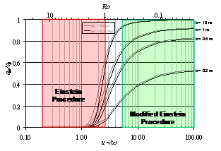
Research: Bureau of Reclamation Automated Modified Einstein Procedure for estimating total sediment load in middle Rio Grande, NM


Refereed Publications:  
  • ASCE Journal of Hydraulic EngineeringSEMEP
  • International Journal of Sediment Research - SEMEPP

Seema Shah-Fairbank completed her graduate studies in Civil Engineering at Colorado State University.  She completed her MS in 2005 and her PhD in 2008.  She graduated from California Polytechnic State University, San Luis Obispo in 2001 with a BS in Environmental Engineering.  Prior to attending CSU she spent 3 years working as a Design Engineer for RBF Consulting in Storm Water Management.  Where, she worked on various flood control, hydrology and hydraulics projects.  She is a Licensed Professional Engineer for the State of California.  She completed her MS degree under the guidance of Dr Pierre Julien in May 2006. 

 
After working with the Bureau of Reclamation Automated Modified Einstein Procedure (BORAMEP) for her Masters degree, she decided that there was opportunity for improving the current Modified Einstein Procedure (MEP).  Her plan is to develop a reliable and accurate way to determine the applicability of MEP.   This will be accomplished by developing an improved total load calculation that will reduce variability and allow calculation in a larger range of conditions.  Validation of the method will be shown and a computer program will be developed to handle the complex calculations outlined in the MEP.  
top


Susan Novak, M.S. Candidate (and Millie)
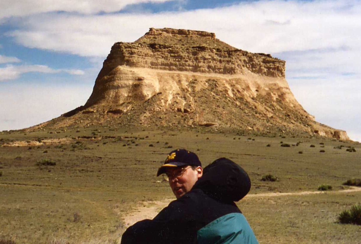
Youngho in some of his favorite surroundings: Pawnee Buttes

Youngho Shin

Ph.D. in 2007 -   Dissertation

Currently working for K-Water in Daejon, South Korea.


Research: 
Effects of Flow Pulses on the River Geometry below Dams 
 
Refereed Publications:  

Map of Nakdong River Basin, South KoreaHapcheon Dam near Jin Joo, South KoreaYoung-ho Shin will take the analysis effects on downstream river channel using aerial photographs which taken before and after dam construction. The study focuses on the aspect of water, sediment and vegetation interaction in the sand bed channel where the river flow is regulated by upstream dams, in order words, hydro-geomorphologic changes in a sand bed channel and thus vegetation expansion on the sandbars in the channel by changes in the flow regime. The study area is the Nakdong River in Korea. This river is the longest river in South Korea with its river length of 506km. The basin area of the river is 23,394km2, the second largest after the Han River (32,200km2). It locates in the south east of the Korean Peninsula and generally the river flows from north to south. The riverbed is composed mostly of sands except in the far upstream in the mountain area where it is composed of gravel and cobble. In the river basin, dams have been built since 1970’s starting from the Andong Dam in 1976. Since then, more major dams including the Imha Dam (completed in 1991) and Hapcheon Dam (completed in 1988) have been built for flood control, water supply and hydroelectric power generation. Also, estuary barrage which is located at the end of Nakdong River have been built to reduce salt-water intrusion and prevent a large flood due to high tides.

top


 Josh enjoys rock climbing in Colorado

Josh Sperry

M.S. in 2022 - Technical Report
Hydraulic Engineering


Research:

Elephant Butte Reach of the Middle Rio Grande,NM

Joshua is pursuing a master's degree in Hydraulic Engineering at Colorado State University with a focus in stream restoration and remediation.
He also received his Bachelor's of Science from Colorado State University in Civil Engineering. In his free time, Joshua rock climbs, skiis, hikes, and travels.

Hydraulic Modeling Analysis
Currently, Joshua is analyzing the Elephant Butte reach of the middle portion of the Rio Grande River in New Mexico from Bosque Del Apache Wildlife Refuge to Elephant Butte Reservoir. The purpose of the analysis is to study the morphodynamic processes of the river to understand how the river is reacting to different human alterations; channelization, mowing operation of the banks, dams, etc. This is done using HEC-Ras, ArcMap, and known physical equations to help better understand the river's characteristics. With this data analysis he is then compiling everything to model and determine suitable habitat for the MRG's endangered Silvery Minnow over time. This analysis will be used to help with conservation efforts for the Silvery Minnow.


seema
Andy enjoys guiding rafting trips in Colorado!

Andy Steininger


M.S. in 2014 - Thesis

Research:
Dambreak modeling with TREX


Leadville, ColoradoTREX Pocess mapAndy Steininger is a master’s degree candidate studying hydraulics and hydrology in the Civil and Environmental Engineering Department at Colorado State University.  He earned a BS in physics from Fort Lewis College in 2005.  12 years as a raft guide and kayaker have provided the necessary interest in river and watershed issues to pursue a degree in civil engineering.

In recent years much interest has developed in two-dimensional modeling of dam failure and flood wave routing.  Andy is currently applying the TREX two-dimensional watershed model to dam break and flood wave scenarios to ascertain the model’s range of applicability to these types of events.  The Environmental Protection Agencies super fund site in California Gulch near Leadville Colorado is being used as the site for these model simulations.    


top


Soo huey
Soo Huey in Iceland!

Soo Huey Teh

M.S. in 2011 -  Thesis
at the School of Renewable Energy Science in Akureyri, Iceland

Currently working at the United Nations University Institute for Sustainability and Peace (UNU-ISI) in Tokyo, Japan. 


Research: 
Upland erosion mapping at Cameron Highlands, Malaysia 

Refereed Publications:  

Map of Nakdong River Basin, South KoreaHapcheon Dam near Jin Joo, South KoreaSoo Huey graduated from University of Hawaii at Manoa with a Bachelor of Science degree in Global Environmental Science and a Minor in Geology and Geophysics. She completed her Masters at the University of Iceland's School for Renewable Energy Science (RES) in Akureyri.  Her Master’s thesis was supported by the Tenaga Nasional Berhad, Malaysia’s largest electric utility company, and co-supervised by Pierre Julien at CSU and Lariyah Mohd Sidek at UNITEN in Malaysia.  Her research was on soil erosion modeling for hydropower development at Cameron Highlands, Malaysia. Uncontrolled deforestation and indiscriminate land clearing for agricultural and housing development resulted in widespread soil erosion over the land surface of Cameron Highlands leading to sedimentation of the rivers and Ringlet Reservoir. Her thesis presented results of a GIS-based analysis of the mean annual soil loss rate using the RUSLE model for the Upper Catchment of Cameron Highlands for the years 1997 and 2006. The results of this thesis will be beneficial for the proposal of a sediment mitigation plan to solve the sedimentation problem at Ringlet Reservoir, Cameron Highlands.  She is currently working as a Programme Associate at the United Nations University Institute for Sustainability and Peace (UNU-ISP) in Tokyo, Japan.

top

seema
Mark seeks to be one with evidence of paleo-sedimentation.

Mark Velleux

Ph.D. in 2005 -  Dissertation
Hydraulic Engineering


Now at Hydroqual, NJ


Research:
Numerical Model to Assess Watershed Contaminant Transport and Fate: TREX
TREX Model

Refereed Publications:  

Unmanaged release of contaminants from upland source areas, their transport across the land surface, and
delivery to stream networks can have adverse water quality and ecological impacts. Examples include watershed transport of acid mine drainage (AMD) and metals from mining areas, metals and organic chemical transport from military training ranges, total maximum daily load (TMDL) sites. Chemical releases cause or contribute to elevated chemical concentrations in water and have toxic effects on aquatic organisms. The U.S. Environmental Protection Agency (USEPA), the U.S. Army Corps of Engineers (USACE), and others need quantitative tools to evaluate watershed contaminant transport and to provide a basis for developing effective management plans that address contaminant impacts at the watershed scale.

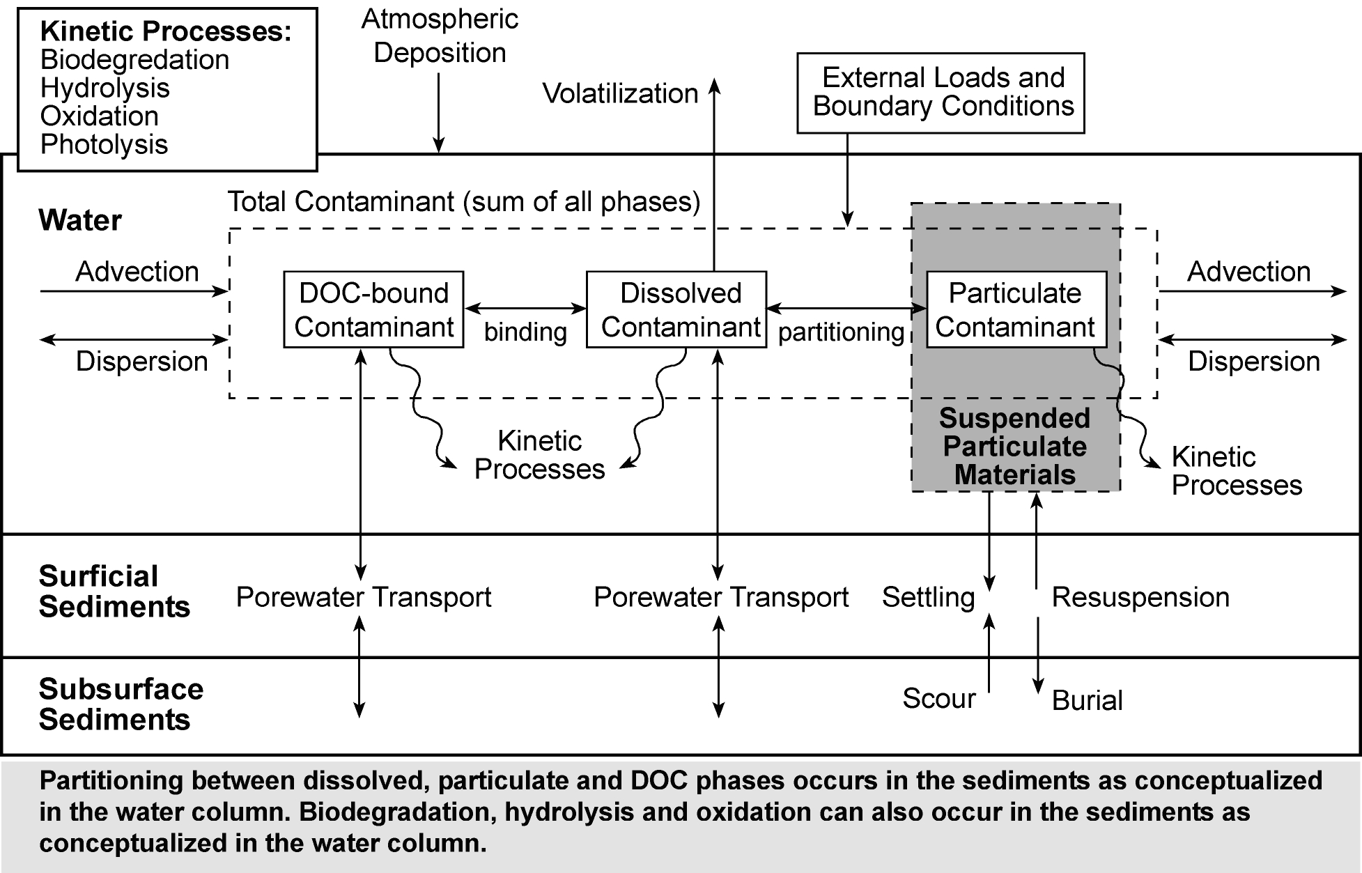
TREX Pocess mapLeadville, ColoradoTo meet this need, a numerical model to simulate the transport and fate of chemicals across watersheds is under development. The model development effort focuses on surface water hydrology with an emphasis on the transport and fate of particle-associated chemicals. A computer code that integrates the most critical hydrologic, sediment transport, and chemical transport and fate processes into a single framework was developed (Figure 1). This new code is called the Two-dimensional Runoff, Erosion, and eXport (TREX) model and is based on Colorado State University’s CASC2D watershed model with chemical transport and fate processes from the USEPA WASP and IPX series of stream water quality models.

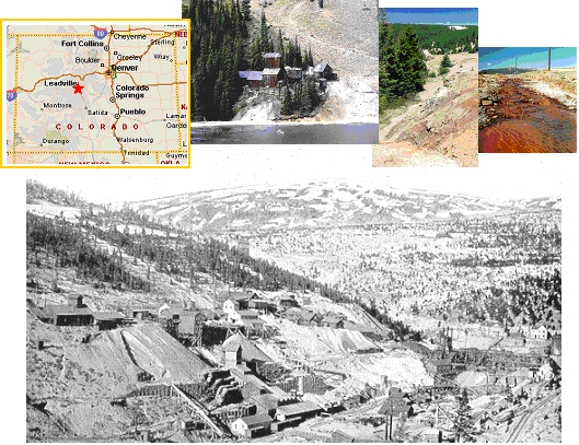
The ability of TREX to simulate chemical transport and fate at the watershed scale is demonstrated by an application to the California Gulch watershed. Located near Leadville, Colorado, the California Gulch watershed is contaminated with wastes from mining activities (Figure 2). Mine wastes are widely distributed across the site. Chemicals of concern include cadmium, copper, and zinc. Click on Figure 3 to see a sample animation showing etals transport from California Gulch to the Arkansas River.  
top


Chad
Chad is from Pennsylvania.

Chad Vensel

M.S. in 2005 - Technical Report
Hydraulic Engineering

Now at URS in Denver


Research:
Hydraulic Modeling Analysis updates on Middle Rio Grande
 

Graduate students at CSU have been examining the Middle Rio Grande for several years.  Changes to the river, induced by the installation of several dams and channelization, have led the US Bureau of Reclamation in Albuquerque, NM to commission hydraulic summary reports of several reaches in the river, including the 10-mile long Rio Puerco and 6.15-mile long San Felipe Reaches. Both reaches are also included in the habitat designation for two federally listed endangered species, the Rio Grande silvery minnow and the southwestern willow flycatcher. In order to facilitate restoration efforts for these species, it has been necessary to determine the historic, current and potential future geomorphic configuration of the channel. 
mrg
The morphology of both reaches were previously studied for changes in the cross-section, width, mean bed elevation, water surface elevation, sinuosity, width/depth ratio, planform geometry, discharge, suspended sediment load and concentration, etc. Computer programs, such as ArcGIS, HEC-RAS, and Geo-Tool, were utilized in this study.  The Rio Puerco Reach has shown a recent (1972-1992) trend toward degradation, thereby decreasing the width-depth ratio and sinuosity, while increasing the velocity and slope. The San Felipe Reach has also shown a recent (1972-1992) trend toward degradation.

The purpose of this particular project is to update the hydraulic summary reports for the Rio Puerco and San Felipe Reaches in order to determine if the recent trendstoward degradation are still evident. This will be completed utilizing the aforementioned computer programs and new data sets from the US Bureau of Reclamation. The project will be completed by the end of fall of 2005.


top


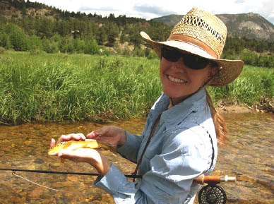
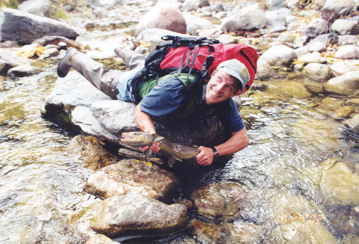
Mark derives a secondary income from his abilities as a trout-herd.
Mark derives a secondary income from catching trout.

Mark R. Weinhold

M.S. in 2001  - Thesis
Hydraulic Engineering

Now working at the US Forest Service
mweinhold@fs.fed.us

Research:
Site calibration and adaptation of gravel transport formulae to cobble bed streams.


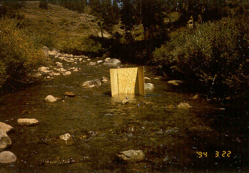
Plywood shield for collecting surface and subsurface bed material samples in Little Granite Creek, WY.I am a part-time graduate student in hydraulic engineering at Colorado State University. Both Oregon State University and CSU felt obliged to offer me a bachelors and masters degree in civil engineering, respectively. In between school and work I managed to become a licensed professional engineer in Oregon and a registered professional hydrologist through the American Institute of Hydrology. In order to insure that my graduate studies progress at a glacial pace, I currently work as the forest hydrologist on the White River National Forest in Glenwood Springs.

My current research centers on using some clever site-calibration techniques to expand the; scope of bedload transport formulae for gravel bed rivers to higher gradient, cobble dominated systems. As stream gradient and bed material size increases, bedload transport; transitions from relatively frequent mobilization of the surface layer to more fine-grained material moving over a relatively immobile bed. Consequently, bedload transport models appropriate for gravel bed streams, such as Parker and Klingeman, Meyer-Peter and Mueller, Wilcock and Crowe, etc., largely over; predict measured bedload transport rates as streambed armoring increases in cobble bed streams. To account for this transition I am reevaluating the role and magnitude of a shear partition in these systems and looking at ways to incorporate surface armoring and variable reference shear as predictor variables in both surface-based and subsurface-based bedload transport equations.

top


Chunyao Yang
Chunyao at work

Chunyao Yang


Ph.D. in 2019 -   Dissertation


Research:
Sediment Yield from Ungauged Watersheds
 

Publications:
Modified Einstein ProcedureIJSR 2019
Sediment Yield of Ungauged WatershedsKSCE 2019
Geospatial Analysis of Soil ErosionCatena 2021

chunyao project photo
Chun-Yao Yang is currently a PhD student in Civil Engineering at CSU. He received his Bachelor’s and Master’s degree in hydraulic engineering from National Cheng Kung University in Taiwan.
His research interests include river mechanics and reservoir sedimentation. He is now working on a project funded by K-water from Korea. The goal of the project is to to estimate the sediment yield for ungauged watersheds in Korea. Chun-Yao will conduct statistical analysis to understand what are the factors controlling the amount of sediment production.

top


Visiting Scientists and REU's


Marielle Remillard - REU 2007

Marielle Remillard studies mathematics and biology at Austin College.  She came to CSU in 2007 for the Summer Water REU program.  During that time, she prepared a report for the New Mexico Bureau of Reclamation on the geomorphic and hydraulic characteristics of the Galisteo Reach of the Rio Grande.  She is passionate about water resources and one day hopes to promote the sustainable use of water resources as a global water analyst..


______________________________________________________________________________________________________
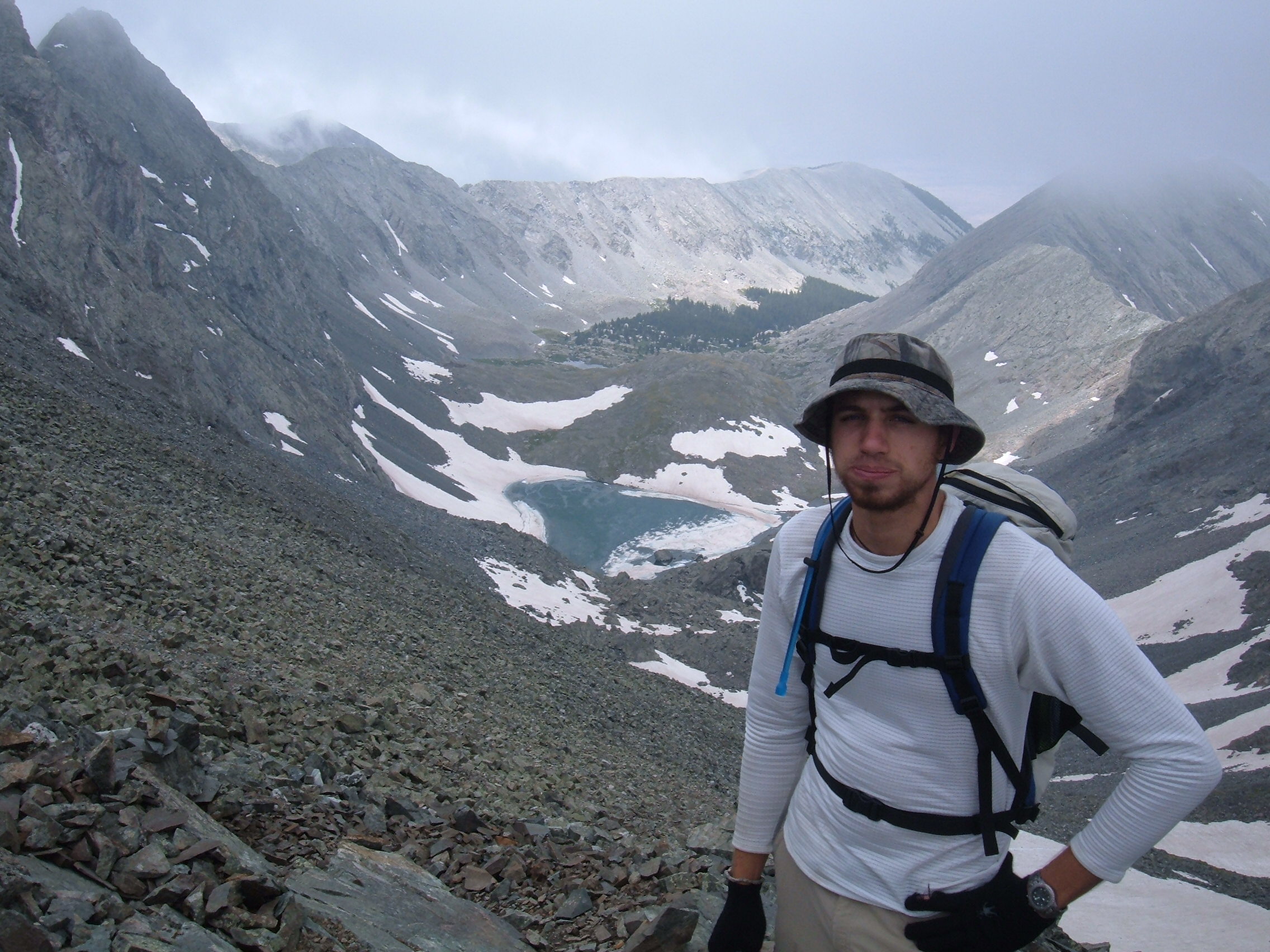
Kevin Hanegan - REU 2008

Kevin is completing his senior year at Louisiana State University majoring in Civil Engineering. He came to CSU the summer of 2008 as part of the NSF's REU program in water resources. Along with Quentin Benally, Kevin worked to update the USBR reach report for the San Felipe reach of the Middle Rio Grande. He performed hydraulic and geomorphic analysis for the study reach using HEC-RAS, Arc-GIS, and other analysis techniques. After graduation, Kevin plans to pursure a masters in either coastal engineering or general hydraulics.  te students at CSU have been examining the Middle Rio Grande for several years.  Changes to the river, induced by the installation of several dams and channelization, have led the US Bureau of Reclamation in Albuquerque, NM to commission hydraulic summary reports of several reaches in the river, including the 10-mile long Rio Puerco and 6.15-mile long San Felipe Reaches. Both reaches are also included in the habitat designation for two federally listed endangered species, the Rio Grande silvery minnow and the southwestern willow flycatcher. In order to facilitate restoration efforts for these species, it has been necessary to determine the historic, current and potential future geomorphic configuration of the channel.  Kevin is currently a PhD student at the University of New Orleans working in coastal engineering.


_______________________________________________________________________________________________________
Quentin Benally - AGEP-McNAIR 2008

Quentin is attending the Engineering program at San Juan College in Farmington, New Mexico.  He joined Dr. Julien’s team in the summer of 2008 as a research participant in CSU’s Alliancefor Graduate Education and the Professoriate (Agep-McNair), which was aimed toward students with an interest in pursuing a Masters Degree or PhD.  He worked with Kevin Hanegan, under the supervision of Dr. Julien and Seema Shah-Fairbank, with the Hydraulic Analysis of the San Felipe Reach, Middle Rio Grande, from Arroyo Tonque to Angostura Diversion Dam.  He gained research experience, working with databases, hydraulic analysis using HEC-RAS, historic planform observations using Arc-GIS, and other traditional research techniques.  In the report, he also shared his knowledge of the area and affects of past management to the surrounding Indian communities.  After finishing at SJC, he plans to earn a Civil Engineering degree from a nearby university.  After experiencing research, working at the Engineering Research Center, meeting new people, enjoying the local environment, Fort Collins and CSU is a possibility.


_______________________________________________________________________________________________________
Duangrudee Kositgittiwong - Visiting Scientist in 2008 - PhD dissertation

Papers on stepped spillways: ICE, J. Mech Eng. and Ovidius

Duangrudee Kositgittiwong received a Ph.D. from King Mongkut’s University of Technology Thonburi (KMUTT), Bangkok, Thailand. She previously graduated from KMUTT in 2005 with a B.Eng. in Civil Engineering. She studied maximum scour downstream of bed sills for her senior project. After that, she works for Water Resources Engineering Research Laboratory, WAREE lab., as a research assistant. She got the Royal Golden Jubilee Ph.D. program scholarship to study in master and Ph.D. program, in water resources engineering, in Thailand. She came to CSU, as an exchange visitor, since January 2009 to study and do her research for a year. She is interested in flow through stepped spillways. Gambit and Fluent model were used in the research to work for flow computation.


_______________________________________________________________________________________________________
Anna Paris - Visiting Scientist in 2008-09

Paper on mudflows and closure

Sediment analysis of the Gila River

Anna Paris joined Dr. Julien’s team in November 2008 as a Visiting Scientist. She graduated from University of Trento (Italy) in October 2008 with a MS in Environmental Engineering focused on hydraulics. She has been studying debris flows mechanics both experimentally and numerically at the CUDAM hydraulics lab in Trento developing for her Master’s thesis a resistance formula able to describe debris flow behavior ranging from mature debris flow to hyperconcentrated bed load transport. She got a scholarship from FTU in Italy to continue her studies concerning River Engineering and Hyperconcentrated flows at CSU.  In Fort Collins, she developed a statistical-numerical sediment analysis of Gila River (Arizona) and has been working on the hydraulic analysis of the Middle Rio Grande for the USBR. The object of study was  a 20-miles long reach stretching from the Arroyo de las Cañas to the South Boundary Bosque del Apache in central New Mexico. The change in hydraulics and morphology over the last 50 years has been studied using software as ArcGIS and HEC-RAS. An interesting phenomenon was also observed: during 2008 the downstream part of the Bosque reach had been experiencing a strong aggradation due to the creation of a sediment plug.


_______________________________________________________________________________________________________

Katharine Anderson - REU 2009 and RA2011

Katharine studies both civil engineering with a concentration in soil and water resources and music at Colorado State University.  She participated in the Summer Water REU Program in 2009 to analyze the Bosque Reach in the Middle Rio Grande.  This analysis was completed utilizing ArcGIS, HEC-RAS and Excel.  She helped prepare a report for the Bureau of Reclamation on the geomorphic and hydraulic characteristics of the 23-mile-long reach.  In 2011, she helped analyze a second reach, the Elephant Butte Reach, for the Bureau of Reclamation.  This 32-mile-long reach is a continuation from the southern end of the Bosque Reach and ends at Elephant Butte Dam.  Due to human influence on the river, the Middle Rio Grande has changed excessively over the past century and many species of native plants and animals have become endangered.   Katharine is interested in river hydraulics and water resources, and hopes to someday pursue a Master’s degree. 


_______________________________________________________________________________________________________


Michelle Ida Anslem - Undergraduate Scholar 2011

Michelle Ida Anslem is an invited undergraduate scholar from UiTM Shah Alam, Malaysia for integrated research program at Engineering Research Center of Colorado State University. She is in her final year now for her studies in Bachelor of Civil Engineering. She worked with Dr. Julien during Fall 2011 on the preparation of Arc-GIS input files for the hydrologic model TREX.  She contributed to the modeling analysis of the Naesung Stream in Korea and the Kota Tinggi River of Malaysia.  Michelle was also involved in processing multiple GIS cross section and the particle size distributions on the Rio Grande in New Mexico.  She learned about data management and report preparation for various hydraulic structures.  She also hopes to pursue her Master’s Degree in hydraulics or hydrology in the near future.


_______________________________________________________________________________________________________
Ladislav Rousar - Visiting Scientist 2013-14

Ladislav Rousar graduated in Civil Engineering from Brno University of Technology (Czech Republic), Institute of Water Structures, in 2011. He continues in Ph.D. program with interest in hydraulics.  He has been studying numerical models for the upper channel of the Prelouc II lock (unsteady 1D model, HEC-RAS) and conducted a parametric study on dike roughness (steady 2D, SMS).   He came to CSU, as an exchange visitor, on fall semester 2013 for better understanding the mechanisms of sedimentation and erosion.  His doctoral thesis will deal with the  determination of incipient motion of homogenous and non-homogenous gravel-bed at high relative roughness and full turbulent flow. Experiments on incipient of motion are verified with field measurements. In additional, his research incorporates a comparison of velocities profiles measured by UVP and those calculated by numerical models (3D, ANSYS-CFX).  With laser scanned bed, he can experimentally determine fall velocity of natural particles and measure bed-load transport over a rectangular broad-crested weir.   

IAHR paper on incipient motion of gravels


_______________________________________________________________________________________________________
Dr. Jai Hong Lee - Visiting Scientist 2013- Professor at South Carolina State University

ENSO Paper on temperature   ENSO Paper on precipitation   ENSO paper on streamflow   Sangju weir paper  ENSO paper on erosivity  Teleconnection discharge 

Teleconnections  Dual Spillway  Temperature TAC 2019   Ungauged Watersheds US Catena  US J.Hydrol  US Theoretical Climatology

Dr. Jai Hong Lee is a postdoctoral research associate with a strong interest in hydrologic research related to climate change. He majored in hydrology and earned a Ph.D. degree at Hanyang University as well as a professional engineer certificate. He worked as a member of design and research team at the Korea Rural Development Corporation, RDC, as a researcher and lecturer for the Department of Civil Engineering at Hanyang University, and as an executive director of the water resources department at the B&Y engineering institute. He carried out a hydrologic analysis of Si-Hwa Sea Barrier Project in 2002, and a hydraulic analysis of the Han River Project in 2005 for the Ministry of Construction and Transportation.
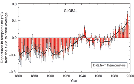
His primary research interest is in the rainfall-runoff analysis of extreme flood such as PMF(Probable Maximum Flood). He is in search for understanding the hydrologic and meteorological impact of climate change, temporal and spatial distribution of rainfall, rainfall-runoff analysis for dam design and river improvement, and reservoir routing and operation. His final goal is to develop an optimal process to accurately estimate extreme storms and floods for the improved design of hydraulic and flood regulation structures. Consequently, accurate estimates of extreme storms and floods would be most important to develop a plan for flood damage mitigation and prevention as well as a disaster management policy.

_______________________________________________________________________________________________________
Christoph Matzke - Visiting Scientist 2014-15
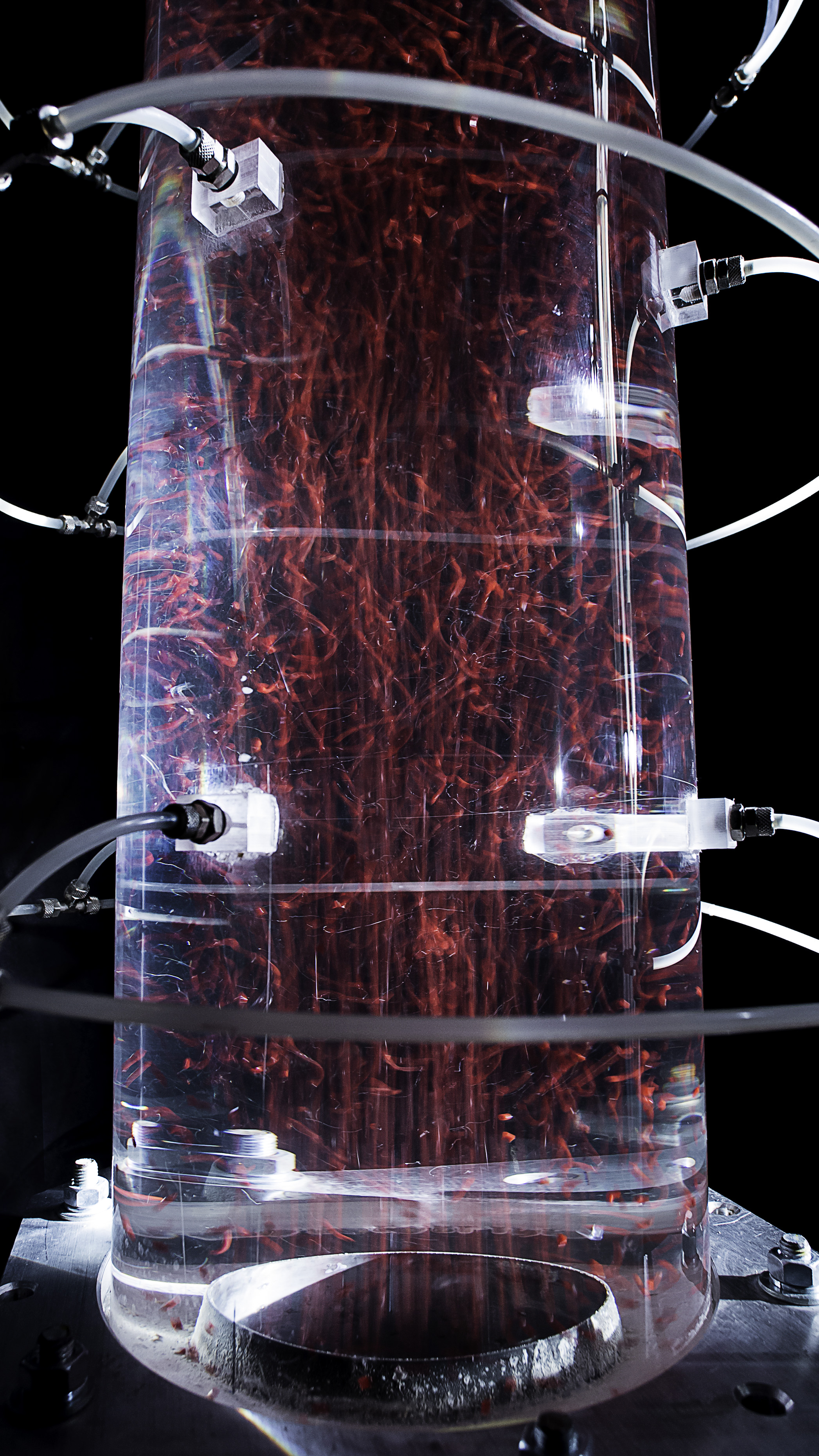
Christoph visited CSU from July to December 2014 under a Marshall Plan Scholarship to study hydraulic losses in aerated surge tank throttles. He graduated in Civil Engineering from KIT Karlsruhe in 2008. He worked on different international engineering projects (Geotechnics, Hydropower, Tunneling, Construction and Consulting) for 3 years before returning to the university to write his doctoral thesis at the Unit of Hydraulic Research of the University of Innsbruck in Austria.
 
 His doctoral thesis will deal with the determination of the hydraulic losses of an aerated surge tank throttle. To investigate the impact of the aeration on the hydraulic losses, a physical model was constructed in the hydraulic lab in Innsbruck. Lots of data were collected of these experiments. While visiting CSU, Christoph mainly worked on his experimental data analysis. He also enjoyed the Erosion and Sedimentation class of Prof. Pierre Y. Julien, which  was a great opportunity to learn more about related aspects of hydraulic engineering. Thanks!

_______________________________________________________________________________________________________
Dr. Jose Anderson Batista - Visiting Scientist 2015-16

Landslides

Landslides happen every year all around the world with different spatial densities. As much as the landslide density increase, more the mud and
debris flow advances through downstream canals causing severe damages to the overbank infrastructure and occupation. Such damages often
reach more than one billion US dollars. In Brazil, the more vulnerable region to landslides is comprehended by the Atlantic Highland Landform
(ranged from 13 to 26 lat. degrees), where some of the richest cities are located. Between 2011 and 2014 severe storms triggered landslides
with more than 10 slides per squared kilometer, causing thousands of deaths and destroying thousands of buildings in about ten cities.

The aim of this research is to find the natural causes and to model the overall process until the overbank deposit of the 2014's landslides in Itaoca,
where the landslide scars can be more clearly identified by satellite imagery.
The results reached herein are the basis for up coming researches aimed to predict and early warn overbank deposits.


_______________________________________________________________________________________________________

George

George Marino Soares Gonçalves - Undergraduate Scholar 2015

Report  on GRASS Watershed Morphology

George Marino Soares Gonçalves is a Water Engineering student in Brazil at UFPEL and he’s been focusing his major in hydraulics and hydrology.
As an undergraduate scholar from Florida Institute of Technology, he joined a summer research project at the ERC
(Engineering Research Center) of Colorado State University in summer 2015.

George Marino participated in a governmental program called BSMP (Brazilian Mobility Science Program) which gave him the opportunity
to meet Professor Pierre Y. Julien and come to CSU. George spent the entire 2015 summer at CSU working with Dr. José Anderson do Nascimento Batista
on a GRASS GIS 7.0 based manual which focused in watershed morphology functions.
The result of this project can be found online as “User’s guide to GIS GRASS 7.0 for Watershed Morphology” or clicking on the link below.
George Marino wishes go back to Brazil and finish his Water Engineering major and pursue a Master degree in hydraulics in the future.

_______________________________________________________________________________________________________

June

Dr. Seongjoon Byeon - Visiting Scientist 2016 - 17

Dr. SeongJoon Byeon is a postdoctoral visiting scholar. He received his BSc degree in Civil Engineering, his M.S. degree and Ph.D. degree in Hydroinformatics from Incheon National University, Korea, in 2005, 2008 and 2015 respectively. He has also received his M.S. degree and Ph.D. degree in EuroAQUAE Hydroinformatics from University of Nice Sophia Antipolis, France in 2007 and 2014. His research interest includes the combination of computer science and water engineering. He has solid laboratory research experience, as he has been working as a researcher, performing design and analysis work for a number of big water projects. Aside from computer laboratory work, he has field work experience including experiments of the hydraulic characteristics of river structures. He visited DHI in Denmark in 2005, and again as an intern in 2007, where he learned about the use of various DHI softwares and successfully performed research. His current research mainly focuses on the smart water grid. Many problems that are encountered in regards to water balance and resources management are related to challenges of economic development under limited resources and tough competition among various water uses. In order to overcome these difficulties, water management has to articulate and combine several resources in order to respond to various demands while preserving the ecological quality of the environment.
In addition, he also carried out several researches on experiments to investigate hydraulic characteristics of river structures. 


_______________________________________________________________________________________________________.
Lingyun

Dr. Lingyun Li - Visiting Scientist 2016 - 17

Dr. Lingyun Li came to CSU as a visiting scholar in 2016. He received his bachelor degree and doctoral degree in Department of Hydraulic Engineering in Tsinghua University, China, in 2005 and 2010 respectively. His doctoral thesis dealt with the relationship between the alluvial river morphology and the flow and sediment regime. He worked as a researcher at the Changjiang River Scientific Research Institute, China, since 2010. His research interest includes the river mechanics and sediment transport. His current research mainly focuses on the delayed response of geomorphology of river channel on the altered flow and sediment regime.
While visiting CSU, Dr. Li mainly worked on analysis the different characteristic of the flow discharge, sediment load, and river channel in the middle and lower reach of Yangtze River in China pre- and post the Three Gorges dam operation. He also carried out a presentation about the delayed response model of Yangtze River during his stay.


_______________________________________________________________________________________________________.

Joonhak

Dr. Joonhak Lee - Visiting Professor 2017

Catena article on soil erosivity

Joon-hak Lee joined Dr. Julien’s team in July 2016 as a visiting scholar. He completed his Ph.D. in Civil and Environmental Engineering at Yonsei University in South Korea. One of his committee members was Prof. Jose Salas at Colorado State University, and his chief advisor at Yonsei University was Prof. Jun-haeng Heo who obtained his Ph.D. from Colorado State University. He has been a tenured associate professor in Civil and Environmental Engineering at Korea Military Academy since 2014.
Dr. Lee’s research interests are rainfall erosivity, soil erosion and sedimentation, statistical hydrology & hydraulics, landslides and GIS modeling. He is a principal investigator of “Development of Rainfall Erosivity Model in Korea (2015 – 2018)” supported by the National Research Foundation of Korea (NRF). His main research in USA is focused on investigating the relationship between rainfall erosivity and sedimentation.


_______________________________________________________________________________________________________.
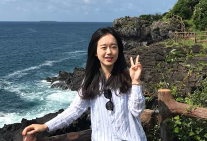

Eunkyung

Dr. Eunkyung Jang - Visiting Scientist 2017 - 18

Catena article on specific degradation data mining

Dr. Eun-kyung Jang have been a researcher at CSU Julien's lab since September 2017. She graduated with a BS (2010), MS degrees (2012), and completed her Ph.D. (2017) from Civil and Environment Engineering at Myongji University in Korea. Dr. Jang researched the sediment discharge assessment to develop the optimum method using Data Mining for Ph.D. Dissertation.
Until recently, she worked at Korea Institute of Civil Engineering and Building Technology (KICT) where the organization researches construction policies and develops technologies in Korea. Currently, she is focusing on studies related to hydraulic engineering and river mechanics. Sediment analysis for Nakdong River at the confluence and stable channel design for Cheongmi, Wonju, Naesung Stream are the main projects. She has also published and expected to publish the journal papers (KSCE, IJSR etc.).


_______________________________________________________________________________________________________.

Xudong

Dr. Xudong Chen - Visiting Professor 2017 - 18

Dr. Xudong Chen has been a researcher at CSU Julien's lab since December 2017. She got her B.S. (2009) and Ph.D. (2014) degree, in Hydraulic Structure Engineering, from Hohai University in China. Dr. Chen studied the dam safety evaluation to develop the analysis methods for working behavior evolution of Roller Compacted Concrete (RCC) dams for Ph.D. Dissertation.
Until recently, she worked as an assistant professor at the water conservancy and environment department of Zhengzhou University in China. Research area of the department lies in water resources, hydrologic and hydraulic engineering. Currently, she is focusing on studies related to hydraulic engineering and river mechanics. Seepage safety evaluation for RCC Longtan dam under the influences of water pressure, temperature and time effect is the main objective. She is expected to publish some conference and journal papers on dam safety during her stay.


______________________________________________________________________________________________________
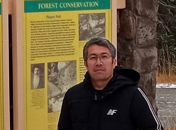
Alisher

Dr. Alisher N. Khazratov – Visiting Scholar 2021 khazratov@gmail.com

Alisher came to CSU from August to December 2021 as a visiting scholar from Uzbekistan under Faculty Enrichment Program. His research interest includes numerical modeling of sediment transport (1D, HEC-RAS 1D and 2D), stable canal design, and river morphology. During his stay in CSU, he carried out LSPIV experiments with Professor Robert Ettema to investigate bendway weirs and rock vanes.  He also participated in the Erosion and Sedimentation class of Professor Pierre Y. Julien to deepen his knowledge in sediment transport processes.

top