
Department of Civil & Environmental Engineering
Walter Scott, Jr. College of Engineering
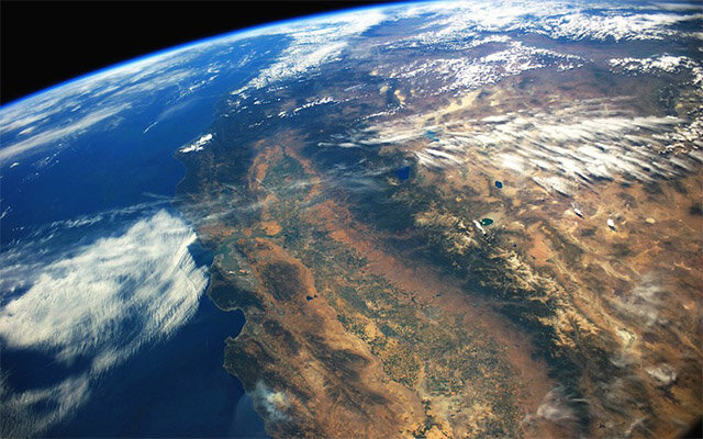
Groundwater stores more than 99% of the world’s liquid freshwater, and is increasingly tapped as climate change exacerbates droughts. Consider the current record-breaking low snowpacks in the western U.S., which will almost certainly lead to significant groundwater pumping this summer to supplement diminished surface water supplies. As reliance on groundwater increases, many basins across the United States and world are at some stage of implementing groundwater management plans. To be effective, these plans must set targeted groundwater withdrawals that enable use of water by the communities that need it, while avoiding or reducing negative impacts of over-use, such as aquifer storage loss, subsidence, depletion of streams, and contamination. A significant challenge remains: most of the world does not measure the volume of groundwater pumped, with estimates often varying by a factor of two. How can we confidently curtail water use if current water use is not known?
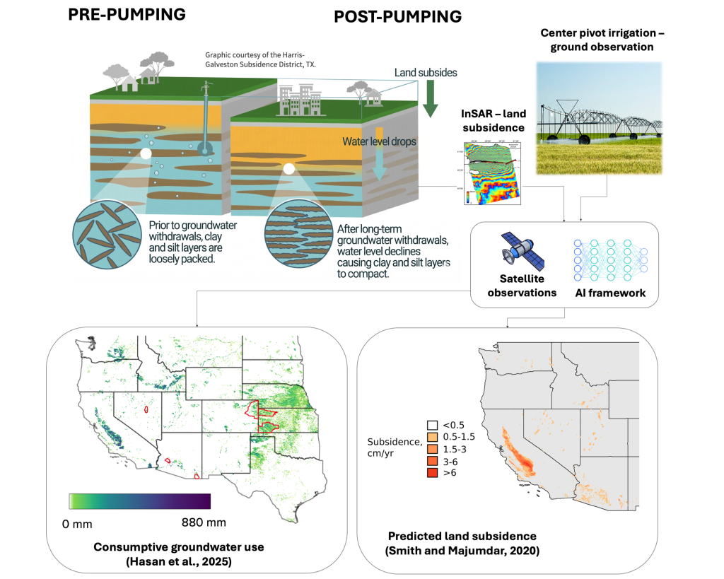
The Remote Sensing Hydrology research group at Colorado State University is working to address this issue using satellite datasets. Since the vast majority of un-metered withdrawals come from agriculture, estimating water use for irrigation is critical. Leveraging limited pumping records, our research group implements AI solutions to estimate groundwater use with satellite estimates of evapotranspiration and other proxies for plant water demand and irrigation efficiency in the High Plains Aquifer, the Mississippi Alluvial Aquifer, several Basin and Range Aquifers, and major watersheds of the world. Recent work by Ph.D. student Fahim Hasan has extended these estimates to the entire Western U.S. using a novel approach to subtract effective precipitation from evapotranspiration estimates by OpenET. While these methods show promise, more metered records of groundwater use are still needed to provide higher confidence estimates, especially in high-use regions like California.
Groundwater withdrawals can lead to land subsidence, or sinking of the land surface. Land subsidence is also linked to groundwater storage loss, which is often irrecoverable. In the Central Valley of California, United States, Mexico City, Mexico, Tehran, Iran, the east coast of China, Jakarta, Indonesia, and many other parts of the world, the land surface is sinking by 10 cm/year or more due to groundwater pumping. Even after pumping ceases, delayed subsidence often continues due to the slow release of water from soft clays that are susceptible to consolidation.
Interferometric Synthetic Aperture Radar (InSAR) provides high-resolution estimates of land deformation with mm accuracy, which can be used to track groundwater storage changes. This technique is most effective in clay-rich, confined aquifers. Our research group leverages these data to improve estimates of groundwater storage loss in southwest Utah, southern Colorado, and the Central Valley of California. We are also developing models to forecast future subsidence given different management scenarios. Our research shows that it is possible to stop subsidence early by artificially recharging aquifers, but it requires proactive groundwater management.
Withdrawals are the biggest gap in groundwater measurements, as they are crucial in water accounting and assessment of storage change. To develop sustainable solutions for groundwater management, we need greater accuracy in our estimates of groundwater use. Leveraging current AI and satellite technologies, we can supplement existing ground-based water use measurements. Research in our group has been done in collaboration with water managers, including state and local agencies, in Arizona, Utah, Mississippi, and Colorado. By providing policy makers and those that implement policy with actionable information about current and historical pumping trends, sustainable volumes of groundwater that can be pumped, and the best locations to recharge aquifers when water is available, we hope to provide them with the tools necessary to implement practical solutions for improved water use.